
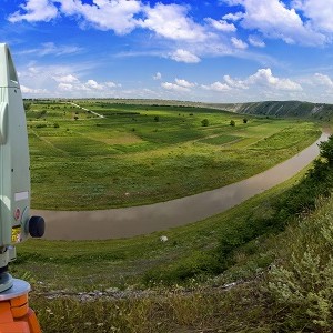
Geographic Information Systems (GIS) are specialized software tools that environmental scientists use to visualize, analyze, and interpret spatial data. GIS has become essential across environmental science specializations, enabling professionals to track species migration, model climate patterns, plan conservation efforts, and assess environmental impacts. Most environmental science programs now include GIS training at undergraduate or graduate levels, with median salaries for environmental scientists reaching $80,060 nationally as of 2024.
If you're considering environmental science as a career, you'll encounter Geographic Information Systems in virtually every specialization—from wildlife conservation to urban planning to climate research. Understanding GIS isn't just helpful anymore; it's increasingly essential for environmental professionals. Whether you're tracking endangered species populations, assessing pollution impacts, or planning sustainable development projects, GIS provides the spatial analysis framework that transforms raw environmental data into actionable insights.
What makes this particularly relevant for students today is that GIS has evolved from an expensive, specialized tool available only to large research institutions into an accessible technology that you'll likely use during your degree program. The software that once cost thousands of dollars and required dedicated workstations now runs on laptops, with free student versions available from major providers. This democratization of GIS technology means that by the time you graduate, spatial analysis skills will be as fundamental to your environmental science toolkit as statistical analysis or field sampling techniques.
On This Page:
- What is GIS?
- GIS in Environmental Science Education
- How Does GIS Work?
- Skills You'll Develop Through GIS Training
- History and Evolution of GIS
- Real-World GIS Applications in Environmental Science
- Getting Started with GIS
- Frequently Asked Questions
- Key Takeaways
What is GIS?
GIS—Geographic Information Systems (or Geographic Information Science)—refers to specialized software that captures, stores, analyzes, and displays geographic data. Think of it as Google Maps meets advanced data analysis: you can visualize where things are located, understand spatial patterns, and answer complex questions about how environmental factors relate across landscapes.
The power of GIS lies in its ability to layer different types of information on top of each other. Imagine overlaying a map showing endangered species habitats with data on land ownership, development proposals, water quality measurements, and climate projections. Suddenly, you can identify conservation priorities, predict impacts, and make informed management decisions based on comprehensive spatial analysis rather than isolated data points.
For environmental scientists, GIS addresses fundamental questions that shape professional practice. Where are pollution sources concentrated relative to residential areas? How has forest cover changed over the past decade? Which watersheds face the highest risk from climate-driven flooding? What's the optimal location for a wildlife corridor connecting fragmented habitats? These aren't just academic exercises—they're the questions environmental consultants, conservation organizations, government agencies, and research institutions grapple with daily.
Understanding geography matters because everything that happens in environmental science happens somewhere. You cannot separate environmental phenomena from location. Water pollution flows downstream to specific communities. Invasive species spread along particular pathways. Climate impacts vary dramatically by region and topography. GIS helps environmental professionals understand these spatial relationships, predict future patterns, and communicate findings through compelling visual maps that stakeholders can immediately understand.
GIS in Environmental Science Education
Most environmental science students encounter GIS during their sophomore or junior year of undergraduate study. The timing varies by program, but there's a clear pattern: foundational environmental courses come first (ecology, chemistry, biology), followed by methods courses that include GIS alongside statistics and field techniques. This sequence makes sense because GIS becomes more powerful when you understand the environmental systems you're analyzing.
Undergraduate GIS courses typically cover fundamental concepts: coordinate systems, data types (vector vs. raster), basic spatial analysis, and map production. You'll learn to use industry-standard software like ArcGIS or open-source alternatives like QGIS. Many programs structure GIS as a two-course sequence—an introductory course covering basics, followed by an advanced course focusing on environmental applications like habitat modeling, watershed analysis, or environmental impact assessment.
At the graduate level, GIS training becomes more specialized. Marine biology students might focus on oceanographic GIS applications. Those pursuing wildlife biology careers learn advanced techniques for tracking animal movements and modeling habitat suitability. Graduate programs often expect students to apply GIS in their thesis research, integrating spatial analysis with field data collection and statistical modeling.
Several universities now offer specialized graduate degrees or certificates in environmental GIS, particularly at the master's level. These programs suit professionals who already hold environmental science degrees and want to add technical GIS expertise to their skill set. Such credentials can significantly enhance career competitiveness, especially for positions in environmental consulting, government agencies, or conservation organizations where GIS proficiency distinguishes qualified candidates.
How Does GIS Work?

At its core, GIS operates through four interconnected processes that transform geographic information into useful knowledge. Understanding this workflow helps you appreciate both GIS capabilities and limitations.
First comes data acquisition. Environmental scientists gather spatial data from numerous sources: satellite imagery, GPS field measurements, digitized paper maps, aerial photography, sensor networks, and existing databases from agencies like the EPA or USGS. The challenge isn't finding data—it's finding the right data at appropriate scales and resolutions for your specific question. A regional conservation assessment requires different data than a site-specific environmental impact study.
Data storage and retrieval form the second component. GIS databases organize spatial information in layers, each representing different environmental features: land use, soil types, water bodies, vegetation cover, and topography. These layers share common geographic coordinates, allowing GIS to overlay and compare them. Modern GIS systems handle enormous datasets—imagine storing high-resolution satellite imagery covering entire states, updated monthly to track environmental changes.
Transformation and analysis represent GIS's real power. This is where environmental questions get answered. Want to identify all wetlands within 500 meters of the proposed development? GIS can calculate that instantly. Need to model how far invasive species might spread based on habitat suitability and landscape connectivity? GIS handles those complex spatial calculations. The software performs operations humans couldn't possibly do manually: measuring distances across irregular terrain, calculating area considering Earth's curvature, or modeling how water flows across landscapes, accounting for topography and soil permeability.
Finally, reporting transforms analysis into communication. GIS produces maps, of course, but also generates tables, charts, and summary statistics that support environmental reports, permit applications, management plans, and scientific publications. The visual nature of maps makes GIS output particularly effective for communicating with non-technical stakeholders—community members understand maps intuitively in ways they might not grasp statistical tables.
Skills You'll Develop Through GIS Training
Learning GIS develops two distinct but complementary skill sets that enhance your overall capabilities as an environmental professional.
Technical proficiency represents the obvious category. You'll learn specific software packages, typically starting with ArcGIS (the industry standard) or QGIS (a powerful open-source alternative). Beyond basic operation, you'll develop skills in data management, understanding different file formats, and database structures. Many advanced GIS users learn scripting languages like Python to automate repetitive tasks—analyzing dozens of satellite images or processing field data from multiple seasons becomes manageable through automation rather than manual clicking.
However, the more valuable skill set involves spatial thinking itself. GIS training fundamentally changes how you approach environmental problems. You begin thinking in terms of spatial relationships, patterns, and processes. When examining an ecological issue, you automatically consider: Where is this occurring? What spatial factors contribute? How does this pattern vary across space? Are there hot spots or clusters? What connects affected areas? This spatial reasoning becomes second nature, making you more effective at designing field studies, interpreting research findings, and developing comprehensive management solutions.
Professional applications of GIS span virtually every environmental career path. Environmental engineers use GIS for site assessment, mapping contamination plumes, and planning remediation projects. Conservation biologists rely on GIS for habitat modeling, tracking species distributions, and prioritizing land acquisition. Environmental planners employ GIS to assess development impacts, identify environmental constraints, and model alternative scenarios. Even laboratory-focused environmental scientists benefit from GIS when contextualizing their findings within broader spatial patterns.
History and Evolution of GIS
GIS emerged in the early 1960s, though the technology you'll use today bears little resemblance to those pioneering systems. The 1962 Canadian Land Inventory conference marked a pivotal moment when researchers theorized that computers could eventually manage and analyze the massive geographic datasets governments were collecting. At the time, this remained largely theoretical—computers were expensive, slow, and had minimal storage capacity.
Through the 1970s and 1980s, GIS remained accessible only to organizations with substantial resources: government agencies, major corporations, and well-funded research institutions. The hardware alone costs hundreds of thousands of dollars, and software packages require specialized training. Fossil fuel companies represented early adopters, using GIS to analyze geological data and identify potential drilling sites. Government agencies developed GIS capacity for land management, resource planning, and infrastructure development.
Two companies emerged during the 1980s that would come to dominate commercial GIS: ESRI (creators of ArcGIS) and MapInfo. Both recognized potential markets beyond traditional government and resource extraction sectors, but GIS remained a specialized tool requiring significant investment.
The internet transformed everything. As connectivity improved through the 1990s and 2000s, geographic data became widely shareable. Government agencies began providing free access to data previously available only through costly purchases. The internet also enabled collaborative GIS projects, with multiple users contributing to and accessing shared databases. Perhaps most significantly, web mapping services like Google Maps familiarized the general public with interactive digital maps, creating a broader understanding of what GIS could accomplish.
The smartphone era accelerated GIS democratization. GPS-enabled devices meant anyone could collect accurate geographic coordinates, transforming field data collection. Cloud computing eliminated hardware barriers—students could now run sophisticated GIS analysis on basic laptops, accessing computational power through internet connections rather than expensive local workstations. Free and open-source software like QGIS matured into legitimate alternatives to commercial packages, removing even software costs as barriers.
For current environmental science students, this historical context explains why GIS appears so prominently in modern curricula despite being rarely mentioned in older environmental science literature. The technology has existed for decades, but only recently became accessible enough to qualify as essential knowledge rather than an optional specialization.
Real-World GIS Applications in Environmental Science
Disaster Response and Climate Resilience
Hurricane Ian's devastation of Florida in 2022 demonstrated both GIS capabilities and limitations in disaster contexts. First responders used real-time GIS mapping to track the extent of flooding, identify accessible routes for emergency vehicles, and prioritize rescue operations. Damage assessment teams overlaid pre-storm and post-storm satellite imagery in GIS to quantify destroyed structures, vegetation loss, and infrastructure damage—information essential for directing federal assistance and insurance claims.
More recently, the 2023 Maui wildfires highlighted GIS applications in rapid environmental assessment. Scientists used satellite-based GIS analysis to map burn severity, identify erosion risks from denuded hillsides, and model potential pollutant runoff into marine environments. This spatial analysis informed immediate erosion control measures and longer-term restoration planning.
Climate resilience planning increasingly relies on GIS for modeling future scenarios. Coastal communities use GIS to project sea level rise impacts under different climate scenarios, identifying critical infrastructure at risk and evaluating potential adaptation strategies. The technology allows planners to visualize which neighborhoods face flooding by 2050 or 2100, supporting difficult decisions about whether to fortify, adapt, or relocate.
Public Health and Environmental Justice
The COVID-19 pandemic revealed GIS as essential infrastructure for public health response. Epidemiologists used GIS to track disease spread, identify hot spots, optimize testing site locations, and plan vaccine distribution. While pandemic mapping garnered headlines, environmental health applications of GIS continued throughout: mapping lead exposure risks in aging infrastructure, analyzing cancer clusters relative to industrial facilities, and assessing air quality disparities across neighborhoods.
Environmental justice applications represent growing GIS use in addressing systemic inequities. Researchers overlay demographic data with environmental exposure information—proximity to polluting facilities, air quality measurements, access to green space—revealing patterns of disproportionate environmental burden on marginalized communities. This spatial evidence supports policy advocacy and enforcement actions, transforming anecdotal community concerns into documented patterns requiring response.
Conservation and Wildlife Management
GPS collar data from wildlife creates massive spatial datasets that only GIS can effectively analyze. Conservation biologists use GIS to map individual animal movements, identify critical habitats, and model population connectivity across fragmented landscapes. When planning wildlife corridors to reconnect isolated populations, GIS analyzes potential routes considering habitat quality, human development patterns, and landscape permeability.
Marine conservation relies heavily on GIS applications adapted for oceanic environments. Oceanographers and marine biologists use GIS to map fishing pressure, track vessel movements, model ocean currents affecting larval dispersal, and design marine protected area networks that account for species migration patterns and ecosystem connectivity.
Renewable Energy and Sustainable Development
The renewable energy transition depends substantially on GIS analysis. Solar farm developers use GIS to identify optimal locations considering multiple factors: solar radiation intensity, land ownership patterns, proximity to transmission infrastructure, environmental constraints (avoiding wetlands and critical habitats), and distance from residential areas. Wind energy siting involves similar multi-criteria GIS analysis, adding factors like wind speed patterns and migratory bird pathways.
Urban sustainability planning employs GIS to model scenarios: What happens to urban heat island effects if we increase tree canopy by 20%? Where should we prioritize green infrastructure to reduce stormwater runoff? Which neighborhoods lack adequate park access? These questions demand spatial analysis across multiple environmental and social dimensions—precisely what GIS excels at providing.
Archaeological and Cultural Resource Management
Environmental scientists working in cultural resource management use GIS to predict archaeological site locations before ground-disturbing activities. By analyzing patterns in known archaeological sites relative to environmental factors—proximity to water, elevation, soil types, past vegetation patterns—GIS models can identify high-probability areas requiring survey before development proceeds. This application demonstrates GIS versatility beyond obvious environmental uses.
Getting Started with GIS

Fortunately for students, GIS entry barriers have essentially disappeared. Most universities provide free access to ArcGIS through educational site licenses. If your program doesn't offer this, or if you want to explore GIS before committing to courses, several excellent options exist.
QGIS represents the leading open-source GIS platform, offering professional-grade capabilities at no cost. The software runs on Windows, Mac, and Linux systems, with extensive online documentation and tutorials. Many environmental professionals use QGIS daily for legitimate consulting and research work—this isn't merely a "learning version" but a fully capable GIS platform.
Web-based GIS platforms like ArcGIS Online and Google Earth Engine allow cloud-based spatial analysis requiring only a web browser. These platforms particularly excel at working with satellite imagery and large environmental datasets, letting you analyze vegetation patterns or land use change without downloading gigabytes of data to your laptop.
Learning resources abound online. The ESRI Training website offers hundreds of free courses covering everything from absolute basics to advanced environmental applications. QGIS provides extensive documentation and video tutorials. YouTube hosts countless GIS tutorials at every skill level. Many community colleges offer affordable online GIS certificate programs for those wanting structured learning outside traditional degree contexts.
For environmental science students, the key is starting early and practicing regularly. Don't wait until required coursework to explore GIS—familiarity with basic concepts before formal classes allows you to focus on environmental applications rather than struggling with software mechanics. Even an hour monthly exploring GIS using free tools builds comfort and spatial thinking skills that compound throughout your education and career.
Frequently Asked Questions
What is GIS, and why is it important for environmental science?
GIS (Geographic Information Systems) is specialized software for visualizing, analyzing, and interpreting spatial data. It's essential for environmental science because virtually all environmental phenomena have geographic components—pollution spreads across landscapes, species occupy specific habitats, and climate impacts vary by region. GIS helps environmental professionals understand these spatial relationships, predict patterns, and communicate findings effectively through maps and spatial analysis.
Do I need programming skills to use GIS?
Basic GIS work requires no programming knowledge—modern GIS software features point-and-click interfaces for the most common tasks. However, learning scripting (particularly Python) significantly enhances GIS capabilities, allowing you to automate repetitive analyses and work with larger datasets efficiently. Many environmental science programs now include introductory programming alongside GIS training, recognizing how these skills complement each other.
What careers require GIS expertise?
GIS skills enhance competitiveness across environmental careers. Conservation organizations, environmental consulting firms, government agencies (EPA, USGS, state environmental departments), urban planning departments, natural resource management agencies, and research institutions all regularly seek candidates with GIS proficiency. Dedicated GIS specialist positions exist, but increasingly, employers expect environmental scientists to possess functional GIS skills rather than relying solely on GIS specialists.
When should I take GIS courses in my environmental science degree?
Most programs sequence GIS after foundational courses in ecology, chemistry, and biology—typically sophomore or junior year. This timing allows you to understand environmental systems before learning to analyze them spatially. Some students take introductory GIS earlier to build comfort with the technology, then pursue advanced environmental GIS applications later in their degree program.
What's the difference between GIS and regular mapping software?
Regular mapping software (like Google Maps) displays geographic information for navigation and visualization. GIS goes far beyond display—it analyzes spatial relationships, performs complex calculations considering terrain and distances, layers multiple data types for comparison, and models spatial processes. Think of regular mapping as reading a book, while GIS is writing, editing, and analyzing the text.
Is GIS difficult to learn?
GIS has a moderate learning curve. Basic operations (displaying data, creating simple maps) become intuitive quickly. Developing proficiency with advanced spatial analysis requires practice and environmental science knowledge to ask meaningful questions. Most students find GIS more accessible than statistics—the visual nature of maps provides immediate feedback about whether analyses make sense, whereas statistical outputs can seem abstract.
What software programs do environmental scientists use for GIS?
ArcGIS (by ESRI) remains the industry standard, widely used across government agencies, consulting firms, and research institutions. QGIS offers a powerful free alternative increasingly adopted by organizations and professionals. Specialized tools exist for specific applications: Google Earth Engine for satellite imagery analysis, R and Python libraries for statistical-spatial integration. Most environmental professionals develop competency in multiple GIS platforms rather than relying exclusively on one.
Key Takeaways
- GIS is Essential Across Environmental Careers: Nearly all environmental science specializations now require or substantially benefit from GIS proficiency, from wildlife biology to environmental consulting to climate research. The technology has evolved from a specialized tool to a fundamental skill comparable to statistics or field methods.
- Accessible Technology for Students: Free software (QGIS), student licenses (ArcGIS), and cloud-based platforms have eliminated cost barriers. Students can begin exploring GIS before formal coursework, building valuable familiarity that enhances learning in required classes.
- Strong Career Advantages: Environmental scientists with GIS skills command competitive salaries—the national median for environmental scientists reached $80,060 in 2024, with higher earnings for those possessing advanced technical skills. The field projects 6% growth through 2032, with approximately 6,900 annual openings.
- Integrated Educational Pathways: Most environmental science programs include GIS training at the undergraduate level, typically in the sophomore or junior year after foundational courses. Graduate programs often require GIS application in thesis research, while specialized GIS graduate certificates serve professionals, adding technical expertise to existing environmental degrees.
- Spatial Thinking Develops Problem-Solving Capabilities: Beyond software proficiency, GIS training fundamentally changes how you approach environmental problems, encouraging systematic analysis of spatial patterns, relationships, and processes. This spatial reasoning skill set applies throughout environmental careers regardless of specific job duties.
Ready to explore environmental science programs with strong GIS training? Discover degree programs that will equip you with the spatial analysis skills environmental careers increasingly demand.
Additional GIS Content Regarding Environmental Science
- Agricultural Science & GIS
- Climate Science & GIS
- Environmental Biology & GIS
- Environmental Engineering & GIS
- Environmental Microbiology & GIS
- Environmental Planning & GIS
- How Sustainability Uses GIS
2024 US Bureau of Labor Statistics salary and job growth figures for Environmental Scientists and Specialists reflect national data, not school-specific information. Conditions in your area may vary. Data accessed January 2026. Learn more at BLS.gov
- What Is Parasitology? The Science of Parasites Explained - November 19, 2018
- Desert Ecosystems: Types, Ecology, and Global Importance - November 19, 2018
- Conservation: History and Future - September 14, 2018
Related Articles


Featured Article
Natural Gas 101: Pros, Cons & Career Guide