
Geographic Information Systems (GIS) have become essential tools for environmental biologists studying land use changes, habitat connectivity, and ecosystem management. While no standalone undergraduate GIS degrees exist in the US, environmental biology students should pursue GIS minors or graduate certificates to enhance career prospects in conservation, forestry, and environmental protection.
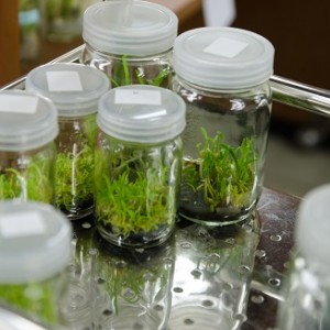
If you're studying environmental biology—or considering it as your major—you've probably realized that understanding where and how living things interact with their environments is just as important as understanding the biology itself. That's where Geographic Information Systems (GIS) come in.
GIS technology allows you to visualize, analyze, and interpret spatial data—essentially mapping biological patterns across landscapes. For anyone planning a career in environmental biology, learning GIS isn't just helpful—it's becoming essential.
Jump to Section
- What Is GIS and Why Does It Matter?
- How Environmental Biologists Use GIS
- GIS in Evolutionary Biology and Phylogeography
- Landscape Conservation and Planning
- Tracking Disease Patterns and Public Health
- How to Learn GIS as an Environmental Biology Student
- Frequently Asked Questions
- Key Takeaways
What Is GIS and Why Does It Matter?
Geographic Information Systems let you work with data that has a location component. Instead of just knowing "this forest has 500 bird species," GIS helps you understand where those species live, how their habitats connect, what threatens them, and how environmental changes affect their populations over time.
The technology pulls together data from different sources—satellite imagery, field surveys, climate records, topographic maps—and helps researchers see patterns that would be invisible otherwise. For environmental biologists, this means you can track deforestation, model habitat connectivity, predict disease spread, or plan conservation strategies based on actual geographic data rather than guesswork.
Instead of a dedicated GIS degree, you'll typically major in environmental biology and add GIS training through minors, electives, or graduate certificate programs. Most colleges and universities now offer at least some GIS coursework—and if your school has it available, it's worth taking advantage of those courses early in your academic career.
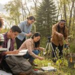
How Environmental Biologists Use GIS
GIS isn't just a mapping tool—it's how environmental biologists make sense of complex ecological data. Here's how professionals in the field actually use it:
Land Use and Deforestation Tracking
One of the most important applications is tracking how landscapes change over time. With urban growth and the need to protect natural areas, GIS has become indispensable for forestry management and conservation planning.
A notable example comes from the Philippines, where researchers used GIS to map deforestation on Sibuyan Island. Mapping tree loss helps measure climate change impacts and manage working forests sustainably.
This kind of work matters for conservation professionals who need data-driven evidence to protect legally designated natural areas.
Understanding Habitat Connectivity
Habitat connectivity refers to how different parts of an ecosystem work together and affect each other. When you cut down trees for farmland or development, you're not just losing trees—you're affecting soil stability, wildlife populations, moss coverage, groundwater levels, and more.
The Sibuyan Island study didn't just count lost trees. It revealed knock-on effects throughout the ecosystem. GIS makes these connections visible, helping biologists understand the full environmental impact of landscape changes.
Crop Improvement and Fisheries Management
While agriculture is primarily the domain of agricultural scientists, environmental biologists use GIS to understand soil quality, improve crop yields in marginal landscapes, and analyze grazing patterns of both livestock and wild animals. This work supports food security in both developed and developing countries.
Similarly, GIS helps manage fisheries by monitoring fish populations and preventing stock collapse. Overfishing has been a concern for over 160 years—British economists worried about North Sea fish stocks as early as 1860.
Environmental biologists have used GIS to track population changes, which helped government agencies like the EPA and EU authorities introduce protective regulations.
Protecting Sensitive Ecosystems
Environmental protection agencies were early adopters of GIS because protected landscapes generate massive amounts of data from competing interests—plant specialists, herpetologists, ornithologists, and others often disagree on management priorities.
The EPA has used GIS for decades to record and monitor protected lands and ocean areas within the US borders. GIS helps present this data flexibly, allowing decision-makers to see the full picture rather than isolated pieces of information.
GIS in Evolutionary Biology and Phylogeography
Since Charles Darwin explained the Theory of Evolution in 1859, we've learned that environmental adaptation is one of evolution's major drivers. GIS is becoming an important tool for tracking evolutionary change across geographic areas.
Phylogeography studies how genetic variation changes across landscapes—how topography, climate, and resources drive speciation even when populations are separated by just a few miles. The three main geographic drivers of evolution are:
- Precipitation: Variations in rainfall, humidity, and water table levels
- Temperature: Which can shift dramatically over small elevations
- Topography: The physical features and form of the landscape
Other factors include local climate, flora and fauna, water quality, and soil composition. Despite its potential, GIS hasn't been fully adopted in evolutionary biology yet—but it's proven valuable for ecological niche modeling and biodiversity informatics, providing data on climate variation and its effects on wildlife.
Case Study: The Red-Cheeked Salamander
Consider Plethodon jordani, the red-cheeked salamander, common in eastern North American mountains. Using GIS, researchers discovered this species has a wider topographical niche than where it's currently found.
This kind of data helps us understand how climate change might affect even common species and project how their populations could shift as they adapt to changing conditions.
For students interested in wildlife biology careers, understanding these spatial analysis techniques becomes increasingly valuable as climate impacts accelerate.
Landscape Conservation and Planning
Conservation decisions often create conflicts. Restoring a wetland might help some species thrive while threatening others that didn't previously face risks.
In delicate ecosystems like rainforests, deciding which areas to protect involves high economic costs in developing economies—even when environmental benefits are immeasurable. Even conservation groups don't always agree on which areas should receive protection.
GIS helps address these issues by presenting up-to-date survey data and allowing quick comparisons. Since most conservation decisions are based on geographic boundaries, the process becomes essentially strategic planning—and GIS excels at strategic planning.
GIS also benefits the study of landscape connectivity—a major factor in biodiversity and conservation. Landscape connectivity concerns how natural environments connect and how human actions and natural processes affect ecology. It's vital for understanding how populations survive in existing landscapes and how we might preserve those landscapes as climate changes.
Tracking Disease Patterns and Public Health
GIS has profound applications in microbiology and health planning. As we work to understand disease-carrying species and their changing behaviors, GIS becomes essential. One major climate change concern is how disease-carrying mosquitoes might expand into areas currently free of tropical diseases.
Southern Europe faces particular risk if malarial mosquitos migrate northward across the Mediterranean as the climate warms—potentially reaching Italy, Spain, southern France, and beyond. Since malaria is environmentally sensitive and climate change effects aren't fully understood, GIS distribution analysis will become increasingly important for health planning.
Risk analyses of African villages in malarial zones have given us clear models for how this works in practice. Health bodies use GIS distribution to understand not just disease spread, but also to model and project potential high-risk areas.
In Singapore, biologists used data from ovitraps—simple plastic devices—plotted into GIS databases to monitor potential Dengue Fever spread. The combination of inexpensive collection methods with GIS has proven efficient even in resource-limited settings.
Similarly, Hawaii used GIS to monitor Dengue Fever threats as a re-emerging disease, possibly exacerbated by climate change. Understanding such re-emergences helps us prepare for future changes.
How to Learn GIS as an Environmental Biology Student
If you're convinced that GIS skills will boost your career prospects, here's how to build that expertise:
Undergraduate Options
Most universities now offer GIS as a minor or through elective courses. If your school has these options, take advantage early—even an introductory GIS course can give you a competitive edge for internships and research positions. Look for courses that focus on environmental or biological applications rather than purely technical GIS.
Graduate Programs
Many environmental biology students add GIS training through master's programs. You can pursue a GIS graduate degree (MS/MA) after completing your bachelor's in environmental biology. Alternatively, look for environmental biology master's programs that incorporate substantial GIS coursework or offer GIS graduate certificates alongside your degree.
Online Learning
Several universities now offer online GIS certificate programs. These work well if you're already employed or if your undergraduate institution doesn't have strong GIS offerings. Many programs combine online coursework with optional in-person labs or field components.
Timeline and Commitment
Basic GIS proficiency typically takes one semester through an introductory course. Advanced skills require 1-2 years of coursework and practical application, often completed during a master's program. The learning curve focuses more on spatial thinking and data interpretation than advanced mathematics—though basic statistical understanding helps.
Related Degrees
Frequently Asked Questions
Do I need a separate GIS degree to use it in environmental biology?
No. Most environmental biologists gain GIS skills through undergraduate minors, electives, or by pursuing a GIS MS/MA after completing their bachelor's degree. The combination of biology expertise and GIS technical skills is what makes you valuable.
What types of environmental biology careers use GIS?
GIS is used across conservation biology, forestry management, wildlife ecology, environmental consulting, urban planning, and government environmental agencies like the EPA. Any role involving spatial data analysis benefits from GIS expertise. Positions in habitat management, species monitoring, and conservation planning particularly rely on these skills.
Can I learn GIS without strong math skills?
While basic statistical understanding helps, GIS software handles most complex calculations. The learning curve focuses more on spatial thinking, data interpretation, and understanding how to apply GIS tools to biological research questions. If you can handle college-level biology and statistics, you can learn GIS.
Is GIS training offered online or only in-person?
Many universities now offer online GIS certificate programs and courses. Some programs combine online coursework with in-person labs or field components for hands-on experience. This flexibility makes it easier to add GIS skills even if your primary institution doesn't have strong GIS offerings.
How long does it take to become proficient in GIS?
Basic GIS proficiency can be achieved in one semester through an introductory course. Advanced skills typically require 1-2 years of coursework and practical application, often completed during a master's program. The key is combining coursework with real research projects where you apply GIS to actual biological questions.
Key Takeaways
- GIS Enhances Biology Careers: Geographic Information Systems allow environmental biologists to analyze spatial data for land use changes, habitat connectivity, conservation planning, and species distribution patterns—skills increasingly essential in modern environmental work.
- No Standalone Undergraduate Degree Required: You don't need a dedicated GIS degree. Environmental biologists typically pursue GIS training through undergraduate minors, elective courses, or graduate MS/MA programs after completing their biology degree.
- Diverse Real-World Applications: GIS supports critical work in deforestation tracking, crop and fisheries management, evolutionary biology research, disease spread prediction, and conservation decision-making across government agencies and private organizations.
- Conservation Planning Tool: GIS enables data-driven decisions about protecting sensitive ecosystems by integrating competing interests, presenting up-to-date survey data, and helping planners balance economic and environmental concerns.
- Growing Career Demand: As climate change accelerates and environmental protection becomes more urgent, the combination of GIS skills with environmental biology expertise creates increasingly valuable career opportunities in research, policy, and field management roles.
Ready to combine environmental biology with GIS skills? Explore degree programs that offer GIS minors and specializations to enhance your career prospects in conservation, research, and environmental management.
- What Is Parasitology? The Science of Parasites Explained - November 19, 2018
- Desert Ecosystems: Types, Ecology, and Global Importance - November 19, 2018
- Conservation: History and Future - September 14, 2018
Related Articles

Featured Article
The Role of Artificial Intelligence in Environmental Sustainability