
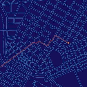
Geospatial technology combines Geographic Information Systems (GIS), remote sensing, and GPS to analyze spatial relationships and environmental patterns. These tools have become essential in environmental science careers, enabling scientists to track climate change, monitor wildlife populations, assess ecosystem health, and plan conservation strategies. Environmental scientists with geospatial skills earn a median salary of $80,060 nationally, with strong 6% job growth projected through 2032.
Geospatial technology has transformed how environmental scientists study and protect our planet. From mapping deforestation in the Amazon to tracking polar bear migration in the Arctic, these powerful tools provide the spatial data and visual insights that drive conservation decisions and environmental policy.
If you're considering a career in environmental science, understanding geospatial technology is no longer optional—it's essential. Whether you're analyzing water quality data, planning habitat restoration projects, or modeling climate impacts, geospatial skills will set you apart in today's competitive job market.
On This Page:
- What is Geospatial Technology?
- Geospatial Technology in Environmental Science
- Geospatial Careers in Environmental Science
- Education and Training Pathways
- Salary and Job Outlook
- Essential Skills for Success
- How to Get Started
- Frequently Asked Questions
- Key Takeaways
What is Geospatial Technology?
Geospatial technology refers to the tools and methods used to collect, analyze, and visualize data tied to specific locations on Earth. For environmental scientists, these technologies answer fundamental questions: Where is the pollution coming from? How fast is the glacier melting? Which habitats face the greatest threat?
The field encompasses three core technologies that work together to provide comprehensive spatial analysis:
Geographic Information Systems (GIS) serve as the analytical engine of geospatial technology. GIS software like ArcGIS and QGIS allows you to layer different types of spatial data—elevation, vegetation, water quality, land use—and analyze their relationships. You might overlay pollution data with demographic information to identify environmental justice issues, or combine satellite imagery with field measurements to assess wetland health.
Global Positioning Systems (GPS) provide the precise location data that anchors all geospatial work. Modern GPS units achieve sub-meter accuracy, essential for marking exact sample locations during field research. Environmental scientists use GPS to track wildlife movements, map invasive species, record soil sampling sites, and navigate to remote study areas.
Remote Sensing captures data about Earth's surface without direct contact, primarily through satellite imagery and aerial photography. These technologies reveal patterns invisible from ground level—urban heat islands, agricultural runoff, forest health, and coastal erosion. Modern remote sensing includes LiDAR (Light Detection and Ranging) for detailed elevation mapping and multispectral imaging that detects changes in vegetation health.
Together, these technologies form a comprehensive toolkit that environmental scientists use daily. The principles and applications of GIS extend across virtually every environmental discipline, making geospatial skills valuable regardless of your specific career focus.
Geospatial Technology in Environmental Science
The real power of geospatial technology becomes clear when you see how environmental scientists apply these tools to solve pressing ecological challenges.
Climate Change Research and Modeling
Climate scientists use geospatial technology to track and model environmental changes over time. Satellite data reveals shrinking ice sheets, shifting vegetation zones, and rising sea levels, with precision impossible through ground-based observation alone. GIS analysts overlay decades of temperature data with ecosystem boundaries to predict how species ranges will shift under future climate scenarios.
Researchers studying climatology and global weather patterns rely on geospatial analysis to identify regional climate trends, model extreme weather events, and visualize the complex interactions between atmospheric systems and land use changes.
Conservation and Wildlife Management
Geospatial technology has revolutionized how we protect endangered species and manage protected areas. Wildlife biologists use GPS collars to track animal movements, identifying critical migration corridors and seasonal ranges. This spatial data informs decisions about where to establish protected areas or wildlife crossings.
Conservation organizations use remote sensing to monitor illegal logging, detect poaching activity, and assess habitat quality across vast areas. A single satellite image can reveal deforestation patterns that would take months to document through ground surveys. These insights directly support conservation strategies protecting biodiversity worldwide.
Environmental Impact Assessment
Before any major development project moves forward, environmental scientists use geospatial analysis to assess potential impacts. GIS helps identify sensitive ecosystems, map endangered species habitat, analyze watershed boundaries, and evaluate how proposed changes might affect air and water quality.
This spatial perspective reveals connections others might miss—a housing development's impact on downstream wetlands, a highway's disruption of wildlife corridors, a factory's potential to affect surrounding neighborhoods. These assessments protect both ecosystems and communities from environmental harm.
Natural Resource Management
Forestry professionals use LiDAR to measure forest structure and estimate timber volume without cutting a single tree. Water resource managers employ GIS to model groundwater flow, identify contamination sources, and plan infrastructure improvements. Agricultural specialists apply precision farming techniques, using GPS-guided equipment and satellite imagery to optimize irrigation and reduce chemical applications.
Each application demonstrates how geospatial technology makes resource management more efficient and environmentally sustainable.
Disaster Response and Planning
When natural disasters strike, geospatial technology provides the rapid situation awareness emergency responders need. Satellite imagery shows flood extent, fire perimeters, and damage assessments within hours of an event. GIS helps coordinate rescue efforts, plan evacuation routes, and prioritize resource allocation.
Environmental scientists also use these tools proactively, mapping flood-prone areas, modeling wildfire risk, and identifying communities vulnerable to sea-level rise. This spatial planning saves lives and reduces economic losses from future disasters.
Geospatial Careers in Environmental Science
Environmental science offers numerous career paths where geospatial skills provide a competitive advantage. Understanding these roles helps you target your education and skill development effectively.
GIS Analyst
GIS analysts create maps, perform spatial analysis, and maintain geographic databases for environmental organizations. You might work for a government environmental agency analyzing air quality data, a conservation nonprofit mapping critical habitats, or a consulting firm conducting environmental impact assessments.
The work combines technical expertise with problem-solving. One day you might map urban heat islands to identify neighborhoods needing more tree canopy, the next you could analyze soil contamination patterns to determine cleanup priorities. A career as a geospatial analyst offers diverse opportunities across environmental sectors.
Remote Sensing Specialist
Remote sensing specialists interpret satellite and aerial imagery to monitor environmental change. This role requires expertise in image processing software, understanding of spectral signatures, and knowledge of how different sensors capture Earth observation data.
You might track deforestation rates for international conservation organizations, monitor crop health for agricultural agencies, or assess glacier retreat for climate research institutions. The ability to extract meaningful environmental information from complex imagery makes these specialists valuable across research and management settings.
Environmental Data Scientist
As environmental datasets grow larger and more complex, scientists who can combine geospatial analysis with advanced statistical methods become increasingly valuable. Environmental data scientists develop predictive models, automate spatial analysis workflows, and create interactive visualization tools.
This emerging field bridges traditional environmental science with computer science and statistics. You might develop machine learning algorithms to detect illegal fishing from satellite data, create web-based dashboards displaying real-time air quality, or build models predicting how invasive species will spread. Programs in environmental data science prepare you for these advanced analytical roles.
Environmental Scientist (with Geospatial Focus)
Many environmental scientists use geospatial technology as one tool among several in their work. You might be a soil scientist mapping contamination at hazardous waste sites, a hydrologist modeling watershed responses to development, or an ecologist tracking habitat connectivity across landscapes.
These positions combine field research with spatial analysis, requiring both technical skills and deep environmental science knowledge. The ability to move seamlessly between collecting samples in the field and analyzing spatial patterns in the office makes you more effective in virtually any environmental science career.
Education and Training Pathways
Building a career in geospatial technology requires intentional education and skill development. Understanding your options helps you choose the path that aligns with your career goals.
Bachelor's Degree Requirements
Most geospatial careers in environmental science require at least a bachelor's degree. You have several options for building this foundation:
A Bachelor's in Environmental Science with GIS coursework provides broad environmental knowledge plus spatial analysis skills. Look for programs offering multiple GIS courses, hands-on projects with real environmental data, and opportunities for GIS-focused internships. Many programs now integrate geospatial methods throughout the curriculum rather than treating GIS as a standalone topic.
A Bachelor's in Geography with an environmental focus offers deep geospatial training while building your environmental science knowledge through electives. Geography programs typically provide the most comprehensive GIS education, including cartography, spatial statistics, and programming for spatial analysis.
Dedicated geospatial science degree programs combine geography, computer science, and applied sciences. These programs prepare you for highly technical roles in remote sensing, spatial database management, and geospatial software development.
Master's Programs and Specializations
A master's degree becomes important for advanced positions, research roles, and specialized applications of geospatial technology. Graduate programs allow you to focus on specific environmental applications—conservation biology, climate science, water resources—while developing advanced spatial analysis capabilities.
Many universities now offer specialized master's degrees in GIS, geospatial intelligence, or environmental informatics. These programs emphasize programming skills, spatial statistics, and custom application development. Others integrate geospatial methods within traditional environmental science master's programs, preparing you to apply these tools within your chosen specialization.
Certificate Programs and Online Options
If you already hold a degree in environmental science or a related field, certificate programs provide focused geospatial training without requiring a full degree program. Many universities and professional organizations offer graduate certificates in GIS that can be completed in one year or less.
Online programs have made geospatial education more accessible. Quality online GIS courses now include hands-on projects, virtual labs, and access to industry-standard software. Look for programs offering real-world datasets and project-based learning rather than just lecture-based instruction.
Essential Software and Tools
Environmental scientists working with geospatial technology need proficiency in several key tools:
ArcGIS remains the industry standard in many government agencies and consulting firms. Its comprehensive toolset handles everything from basic mapping to advanced spatial modeling. Student licenses are widely available, and Esri offers extensive online training resources.
QGIS provides a powerful open-source alternative to ArcGIS. Many conservation organizations and academic researchers prefer QGIS for its cost-effectiveness and flexibility. Learning both ArcGIS and QGIS makes you more versatile in the job market.
Programming languages like Python and R have become increasingly important for automating spatial analysis and working with large datasets. Python integrates seamlessly with both ArcGIS and QGIS, while R offers powerful spatial statistics packages.
Remote sensing software such as ENVI, ERDAS Imagine, or open-source alternatives like Google Earth Engine process satellite imagery and aerial photographs. These specialized tools extract environmental information from raw imagery data.
Salary and Job Outlook
Understanding the financial prospects of geospatial careers helps you make informed educational and career decisions. The field offers competitive salaries with strong growth potential.
National Salary Data
According to the U.S. Bureau of Labor Statistics, environmental scientists and specialists (including those with geospatial expertise) earned the following wages in 2024:
| Wage Category | Annual Salary |
|---|---|
| Mean (Average) | $88,640 |
| Median (50th percentile) | $80,060 |
| 25th Percentile | $62,090 |
| 75th Percentile | $103,730 |
| 90th Percentile | $134,830 |
These figures represent the full range of environmental scientist positions. Professionals with specialized geospatial skills, advanced degrees, and experience in high-demand areas like remote sensing or spatial data science often earn salaries in the upper ranges.
Job Growth Projections
The employment outlook for environmental scientists remains positive. The BLS projects 6% growth from 2022 to 2032, roughly in line with the average for all occupations. This growth translates to approximately 6,900 job openings annually when accounting for both new positions and replacement needs.
Several factors drive this steady demand:
Climate change creates ongoing needs for scientists who can model environmental impacts, assess vulnerabilities, and track ecosystem responses. Geospatial technology provides essential tools for this work.
Environmental regulations require impact assessments, monitoring programs, and compliance reporting—all of which rely increasingly on spatial analysis.
Conservation organizations need professionals who can identify priority areas, track restoration success, and demonstrate program effectiveness through spatial data.
The expansion of environmental data analytics creates opportunities for scientists who combine geospatial skills with advanced statistics and programming.
Geographic Variation
Salaries and opportunities vary by region. States with strong environmental regulations, large federal land holdings, or significant natural resource industries typically offer more geospatial positions. California, Colorado, Washington, and Oregon consistently rank among states with high employment and competitive salaries for environmental scientists.
Urban areas generally provide more opportunities, particularly in government agencies and consulting firms. However, field-based positions with conservation organizations often exist in rural areas near protected lands.
Essential Skills for Success
Technical proficiency with geospatial tools represents only part of what makes you effective in this field. The most successful environmental scientists combine multiple skill sets.
Spatial thinking means understanding how phenomena relate to each other across space. You learn to ask geographic questions: Why is water quality worse downstream? How does elevation affect species distribution? Where will climate impacts occur first? This spatial perspective becomes intuitive with practice.
Data management skills grow increasingly important as datasets expand. You need to organize spatial data logically, document your methods clearly, maintain data quality, and ensure others can understand and use your work. Poor data management creates problems that multiply over time.
Problem-solving abilities distinguish competent technicians from valuable scientists. Geospatial technology provides tools, but you must determine which analyses answer your questions, interpret results correctly, and communicate findings effectively. The technology enables your scientific thinking—it doesn't replace it.
Communication skills matter as much as technical abilities. You'll create maps that convey complex information clearly, write reports explaining spatial patterns to non-technical audiences, and present findings that influence environmental decisions. The most brilliant analysis means nothing if you can't help others understand its implications.
Field research experience keeps your spatial analysis grounded in reality. Understanding how data gets collected, what field conditions look like, and where uncertainty enters the process makes your analysis more accurate and meaningful. The best geospatial professionals move comfortably between office and field.
How to Get Started
Building a career in geospatial technology requires intentional preparation. These steps position you for success, whether you're a high school student exploring options or a professional considering a career transition.
Undergraduate Preparation
Start early if possible. Take geography, computer science, and environmental science courses during your undergraduate years. Many schools offer introductory GIS courses open to students from any major. These introductions help you determine if geospatial work interests you before committing to specialized coursework.
Choose electives strategically. Courses in statistics, database management, programming, and cartography complement your core environmental science classes. The combination of environmental knowledge and technical skills makes you more competitive for both jobs and graduate programs.
Building Your Portfolio
Employers want to see what you can do, not just what courses you've taken. Develop a portfolio showcasing your best spatial analysis projects. Include maps you've created, descriptions of analytical methods you've applied, and explanations of problems you've solved.
Consider creating a personal website displaying your work. Include project descriptions that explain your data sources, analytical approach, and key findings. This portfolio demonstrates your capabilities more effectively than any resume.
Internship Opportunities
Practical experience distinguishes strong job candidates. Pursue internships with environmental organizations, government agencies, or consulting firms. Many positions specifically seek interns with GIS skills, even at the introductory level.
Don't limit yourself to paid positions. Volunteer projects with local conservation organizations or campus research labs build your skills and expand your network. These experiences often lead to references, job leads, or future opportunities.
Professional Certifications
The GIS Certification Institute offers the GISP (GIS Professional) certification, recognized across the industry. While not required for most positions, certification demonstrates your commitment to professional standards and continuing education.
Requirements include documented education, experience, and contributions to the field. Many professionals pursue certification mid-career as they advance into senior positions or independent consulting.
Frequently Asked Questions
Do I need a specific degree in geospatial technology to work in this field?
Not necessarily. While dedicated geospatial degrees exist, many successful professionals hold degrees in environmental science, geography, ecology, or related fields with strong GIS coursework. Employers typically prioritize demonstrated skills over specific degree titles. A bachelor's in environmental science with 3-4 GIS courses, meaningful projects, and internship experience often competes effectively with specialized geospatial degrees. Your ability to apply spatial analysis to real environmental problems matters more than your degree name.
What software should I learn first as a student?
Start with ArcGIS if your school provides access, as it remains the industry standard in many environmental organizations. ArcGIS Online offers a user-friendly introduction before progressing to ArcGIS Pro's more advanced capabilities. Simultaneously learn QGIS, the leading open-source alternative. Many employers value proficiency in both platforms. Once comfortable with either, add Python programming to automate repetitive tasks and work with larger datasets. This combination—commercial GIS software, open-source tools, and basic programming—prepares you for most entry-level positions.
Is geospatial technology a stable long-term career choice?
Yes, for several reasons. Environmental challenges requiring spatial analysis continue growing—climate change monitoring, conservation planning, disaster response, and resource management all depend increasingly on geospatial technology. The 6% projected job growth for environmental scientists remains steady, and positions requiring geospatial skills often see even stronger demand. As organizations collect more location-based data, they need professionals who can analyze and interpret it. The field evolves constantly with new sensors, algorithms, and applications, but core spatial thinking skills remain valuable regardless of technological changes.
Can I work remotely in geospatial environmental science careers?
Many geospatial positions offer remote or hybrid work options, particularly those focused on data analysis, map production, and spatial modeling. However, purely remote work proves less common in roles requiring regular field data collection. Consulting positions and contract work often provide the most flexibility. Government agencies vary widely—some federal positions permit remote work while others require office presence. Entry-level positions typically expect more in-person work for training and mentorship, while experienced professionals gain more remote options.
How important is advanced education for geospatial careers in environmental science?
A bachelor's degree suffices for many GIS analyst and technician positions, particularly in consulting firms and local government. However, a master's degree opens significantly more opportunities, especially in research, federal agencies, and senior positions. If your interests include remote sensing, spatial data science, or academic research, graduate education becomes nearly essential. Consider working 2-3 years after your bachelor's to clarify your career direction before committing to graduate school. Many professionals pursue master's degrees part-time while working, combining education with practical experience.
Key Takeaways
- Essential Environmental Tool: Geospatial technology has become fundamental to modern environmental science, with applications spanning climate research, conservation biology, impact assessment, and resource management across all environmental disciplines.
- Strong Career Prospects: Environmental scientists earn a median salary of $80,060 with mean wages reaching $88,640, and the field projects steady 6% growth through 2032 with approximately 6,900 annual job openings nationwide.
- Multiple Educational Pathways: You can build geospatial expertise through environmental science degrees with GIS coursework, geography programs with environmental focus, or dedicated geospatial science degrees, with many professionals adding specialized training through graduate certificates.
- Technical and Scientific Integration: Success requires combining spatial analysis software skills (ArcGIS, QGIS, Python) with environmental science knowledge, field research experience, and the ability to communicate complex spatial patterns to diverse audiences.
- Diverse Career Applications: Geospatial skills create opportunities across government environmental agencies, conservation nonprofits, environmental consulting firms, research institutions, and emerging fields like environmental data science and climate modeling.
Ready to start your geospatial journey? Explore environmental science degree programs that integrate GIS training with hands-on field research and prepare you for careers using spatial analysis to protect our planet.
2024 US Bureau of Labor Statistics salary and job growth figures for Environmental Scientists and Specialists, Including Health (SOC 19-2041) reflect national data, not school-specific information. Conditions in your area may vary. Data accessed January 2026. View the BLS Occupational Outlook Handbook.
- What Is Parasitology? The Science of Parasites Explained - November 19, 2018
- Desert Ecosystems: Types, Ecology, and Global Importance - November 19, 2018
- Conservation: History and Future - September 14, 2018
Related Articles


Featured Article
How Radiocarbon-14 Dating Works