A GIS specialist builds and analyzes geographic information systems to map spatial relationships and solve location-based problems across environmental conservation, urban planning, and public health. These professionals earn a median salary of $73,690 as of 2022, with demand projected to grow 5% through 2032 as organizations increasingly rely on geospatial data for decision-making.
Geographic Information Systems (GIS) might sound technical, but here's what it really means: it's how we layer different types of geographic data—like rivers, roads, population density, or pollution levels—to answer location-based questions and solve spatial problems. Think of it as Google Maps on steroids, built specifically for analyzing complex relationships between places, people, and environments.
GIS software allows you to overlay maps and datasets and query them in terms of their spatial relationships to each other. For example, you could load different layers for rivers, creeks, and streams, flood maps, and land parcels to determine which homeowners to warn in a storm event.
GIS is an analysis tool that's used in a wide range of areas, including health, city government, transportation, urban planning, business marketing, geology and archaeology. It's used to route emergency and fleet vehicles, determine the best places for new wineries and other businesses, and conducting demographic, market, and political research.
However, the technology was originally created as a conservation tool. In this context, it's used to map wildlife habitats, vegetation ranges, carbon-emission sources, and polluted areas. GIS remains essential for wildlife biologists tracking migration patterns, foresters monitoring carbon sequestration, and environmental consultants assessing site contamination. It's also used to identify conservation areas, site new wind and solar projects, and more.
What Does a GIS Specialist Do?
GIS specialists build and maintain GIS databases and use GIS software to analyze the spatial and non-spatial information in them. They may work under a wide variety of job titles, including GIS Analyst, GIS Technician, and Cartographer.
Here's what makes this career unique: you're part data detective, part environmental scientist, and part visual storyteller. One day, you might be mapping wildlife migration corridors to inform conservation decisions. Next, you're helping emergency managers identify which neighborhoods need evacuation warnings during flood events. Technical skills matter, but the real value lies in understanding how to ask the right spatial questions and communicate your findings clearly.
Their daily activities may include entering various types of data into GIS databases, such as text or spreadsheet files containing latitude and longitude coordinates, tabular data, aerial or satellite imagery, and manually digitizing paper maps or map images. They also analyze GIS data to identify spatial relationships, or display the results of analyses; review GIS data for currency and accuracy; document the parameters and context of GIS data; perform geospatial modeling or spatial analysis; and create thematic maps for environmental and educational purposes.
Many GIS Specialists use desktop GIS software to analyze data and create internal maps. However, they're increasingly involved in launching and supporting online and mobile maps for public consumption. This type of work involves a solid background in computer science and programming. Programming languages such as Python and ArcObjects are also used in desktop mapping to automate processes and create customized tools and workflows.
Where Does a GIS Specialist Work?
GIS specialists primarily work in office environments, using specialized workstations with multiple monitors to handle complex mapping projects. Your setup typically includes high-performance computers running memory-intensive GIS software, large displays for detailed spatial analysis, and often a standing desk, given the screen-heavy nature of the work.
Work settings vary significantly by employer type. Federal agencies like the U.S. Geological Survey or the Environmental Protection Agency offer the highest-paying positions, with extensive resources and cutting-edge technology. State and local government roles provide stable employment with strong benefits, often focusing on land use planning, emergency management, or natural resource management. Private consulting firms offer project variety and faster advancement, but may involve more deadline pressure.
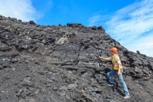
Field work provides welcome breaks from desk-based analysis. You might spend a day GPS-mapping stream locations for watershed assessments, verifying that digitized features match real-world conditions, or collecting ground-truth data using tablets or specialized surveying equipment. Field work typically represents 5-15% of work time for most specialists, though this varies by position.
Remote work has become increasingly common post-2020, with many positions offering hybrid arrangements. The computer-based nature of GIS work adapts well to remote setups, though some employers require periodic office presence for team collaboration and access to specialized hardware or secure data systems.
What Is the Average GIS Specialist Salary?
As of 2022, cartographers and photogrammetrists (which includes GIS specialists) earn a median annual salary of $73,690. Geographic variations are significant: federal government positions offer the highest compensation at approximately $95,000 annually, while state and local government roles provide competitive salaries with strong benefits packages. Those working in management, scientific, and technical consulting services typically earn in the $60,000-$80,000 range, depending on experience and specialization.
Salary progression follows career advancement closely. Entry-level GIS technicians typically start between $45,000-$55,000, while experienced GIS analysts earn $60,000-$75,000. Senior GIS specialists with 5+ years of experience command $75,000-$95,000, and GIS coordinators or managers with supervisory responsibilities can earn $90,000-$120,000 or more.
GIS Career Levels: Responsibilities & Advancement
| Role | Years Experience | Primary Responsibilities | Typical Salary Range |
|---|---|---|---|
| GIS Technician | 0-2 years | Data entry, georeferencing maps, digitizing features, basic map production, quality control checks | $45,000-$55,000 |
| GIS Analyst | 2-5 years | Spatial analysis, workflow design, problem-solving, database management, custom tool development | $60,000-$75,000 |
| GIS Specialist | 5+ years | Complex project management, system architecture, team supervision, stakeholder communication, strategic planning | $75,000-$95,000 |
| GIS Coordinator/Manager | 8+ years | Department oversight, budget management, technology evaluation, policy development, interdepartmental coordination | $90,000-$120,000 |
Geographic Information Systems Jobs & Job Description
Specialist technicians who use, run, develop, and maintain GIS systems perform essential data-collection and analysis functions that many other scientists depend on. Duties vary significantly from job to job, but the following list includes typical job duties one might encounter as a Geographic Information Systems (GIS) Specialist:
- Create maps and graphs, using GIS software and data collection equipment.
- Perform research to obtain and expand existing datasets
- Gather and report on GIS data and determine how data sets are best utilized through GIS
- Compile geographic and demographic data from many sources
- Consult with external stakeholders to access censuses, fieldwork, satellite and aerial imagery, and maps
- Compile data for statistics to incorporate into documents and reports
- Build, manipulate, and update databases
- Enter new map data using cartographic principles
- Analyze and model relationships between geographic data sets
- Operate and maintain GIS system hardware, software, and peripherals
- Present information to clients and stakeholders in verbal or written format
Second-tier GIS technicians and researchers often have team lead or senior advisor roles. Accordingly, they may have more managerial or administrative responsibilities, such as:
- Producing GIS technical documents like proposals and presentations for stakeholders
- Producing funding and grant applications
- Conducting planning, research, analysis, and assessments in order to best direct the project
- Navigating regulatory processes
- Ensuring quality and continuous improvement through innovation, and meeting timelines and benchmarks
- Consulting activities include: project management, tracking billable time, communicating schedules, directing/ supervising staff, and driving profitability
- Successfully bidding for and managing projects and funding opportunities
- Creating a challenging but collegial environment
- Acting as a mentor to junior team members
What Is the Job Demand for GIS Careers?
Employment of GIS specialists and cartographers is projected to grow 5% from 2022 to 2032, creating approximately 600 new positions annually. This growth stems from increasing demand for geospatial data in climate monitoring, urban planning, emergency response systems, and infrastructure development.
Job prospects are solid but competitive. You'll face approximately 2-3 qualified candidates per position in most markets. The advantage goes to candidates who combine formal education with hands-on portfolio work—internships, volunteer GIS projects, or personal mapping projects that demonstrate problem-solving ability. Programming skills in Python significantly improve your competitiveness, with many job postings now listing coding as preferred or required.
It's very important to gain experience as early as possible. This may mean participating in an internship or volunteering for nonprofit organizations to build up a portfolio. A solid portfolio, experience, and knowledge of computer programming are key to being competitive in the job market. Web programming will become increasingly valuable as online and mobile mapping expands.
Essential Skills for GIS Success
Technical proficiency forms your foundation. You'll need a solid command of industry-standard software—ArcGIS Desktop and ArcGIS Pro from Esri dominate the professional market, though open-source QGIS has growing adoption. Database management skills matter more than many realize since you'll work extensively with spatial databases using SQL queries.
Programming ability separates good GIS professionals from great ones. Python remains the most valuable language for automating repetitive tasks, creating custom analysis tools, and extending GIS software functionality. JavaScript is essential for web mapping applications—expect to work with libraries like Leaflet or OpenLayers if you pursue web-based GIS development. R programming supports statistical analysis and specialized geospatial packages.
Spatial thinking represents your unique value proposition. This means visualizing how geographic features relate to one another, understanding map projections and coordinate systems, and recognizing when spatial analysis can reveal patterns that are invisible in traditional data analysis. You develop this skill through practice and coursework, not just software tutorials.
Communication skills close the gap between technical analysis and practical application. You'll translate complex spatial findings into clear maps and reports for non-technical stakeholders. Strong written communication helps you document methodologies and defend analytical decisions. Verbal presentation skills matter for explaining results to community groups, elected officials, or project teams.
Domain knowledge in environmental science, urban planning, or your chosen application area multiplies your effectiveness. GIS is a tool—understanding what questions to ask and how to interpret results requires subject matter expertise in the field you're supporting.
Where Can This Career Take Me?
GIS specialists generally start out as GIS technicians who georeference paper and digital map images (assigning them coordinates), and digitize the information on them, usually by hand. This generally means tracing lines such as roads and streams and polygons such as building or lake outlines. Attention to detail is particularly important for this type of work.
Technicians usually work their way up to GIS Analyst positions within 2-4 years. Analysts are involved in more creative, problem-solving work, such as determining the sequence of analytical operations needed to investigate an area or issue—for example, the best site for a new wind farm. Career advancement often leads to specialized roles in conservation GIS, working alongside foresters on timber management, or supporting urban planning departments on infrastructure projects.
GIS specialists can eventually become supervisors or GIS Coordinators who manage all GIS activities within an enterprise or government department. Some professionals transition into cartography and surveying roles that blend fieldwork with geospatial analysis, or develop expertise in environmental data science to strengthen their analytical capabilities.
What GIS Courses and Degrees Are Available?
GIS specialists usually have a bachelor's degree in geography, cartography, or surveying. These programs are typically offered by geography departments. However, because GIS tools support a wide range of disciplines, classes may also be offered in engineering, forestry, geology, or environmental science programs. Many schools now offer minors, certificates, and master's programs in GIS and other geospatial technologies. However, within the earth and environmental sciences, these offerings generally enhance scientists' skills and credibility rather than stand on their own. For this reason, those interested in applying GIS to environmental issues would be wise to develop a broad background in environmental science, forestry, geology, and related fields, as well as in mathematics and computer programming.
Some states require cartographers to be licensed as surveyors, but only when performing surveying functions. Candidates must have a high school diploma and pass a test.
GIS specialists can also earn certification as a Certified GIS Professional (GISP) through the GIS Certification Institute. GISP certification is industry-recognized, though not state-mandated. The certification has been endorsed by professional organizations, including the National Association of Counties.
Certification renewal is required every five years. Esri Technical Certification is also available for ArcGIS, a suite of popular GIS solutions. While the above certifications are optional, they set candidates apart and demonstrate their skills and dedication. Such certifications are increasingly important for promotions and advancement, often leading to salary increases of 10-15%.
Read more about Geographic Information Systems Degree options.
GIS - Related Degrees
What Kind of Societies and Professional Organizations Do GIS Specialists Have?
- The Society for Conservation GIS (SCGIS) helps conservationists learn about and use GIS in their work through networking, scholarships, and training. It holds an annual conference, hosts a discussion board and job board, and organizes local chapters worldwide.
- The American Society for Photogrammetry and Remote Sensing (ASPRS) is a professional association for the geospatial industry. It offers several types of professional certifications. While optional, these certifications enhance professional credentials and set job seekers apart in a competitive market. It holds annual and specialty conferences, supports divisions, and offers networking opportunities through national job fairs, workshops, and social activities.
- The National States Geographic Information Council (NSGIC) is largely comprised of management-level geospatial specialists, many of whom coordinate state activities. However, any geospatial specialist is welcome to join. NSGIC is an excellent way to learn about other members' new initiatives and to benefit from peer-to-peer mentoring.
- The University Consortium for Geographic Information Science (UCGIS) is an association of over 60 universities that advances research and education in geospatial technologies. It facilitates networking through conferences and provides timely information on grants and contracts in the field to employees of member institutions. Its workshops are open to non-members for a fee.
Environmental applications remain the foundation of GIS work—from tracking deforestation rates to modeling climate change impacts. Professionals in this field often collaborate with sustainability specialists and environmental consultants on conservation planning and resource management projects.
Frequently Asked Questions
Do I need a degree in GIS specifically to become a GIS specialist?
No, you don't need a degree in GIS. Most GIS specialists have bachelor's degrees in geography, environmental science, forestry, geology, or related fields with GIS coursework or certifications. Many professionals enter the field through certificate programs or minors in geospatial technologies, combined with domain expertise in areas such as conservation or urban planning.
What's the difference between a GIS technician, analyst, and specialist?
GIS technicians handle data entry, georeferencing, and digitizing maps—primarily technical execution. GIS analysts perform spatial analysis, determine analytical workflows, and solve location-based problems. GIS specialists (often the same as senior analysts) take on more complex projects, manage GIS systems, and may supervise teams. Career progression typically takes 4-7 years from technician to specialist level.
Is programming knowledge required for GIS work?
While entry-level GIS technician roles may not require programming, career advancement increasingly demands coding skills. Python is the most valuable language for automating workflows and creating custom tools in ArcGIS. JavaScript knowledge is essential for web mapping applications. Many professionals learn programming on the job as they build their GIS careers.
Can I work as a GIS specialist remotely?
Many GIS specialist positions offer remote or hybrid work options, especially in consulting firms and federal agencies. The work is largely computer-based, making it well-suited to remote arrangements. However, some positions require occasional field work for data verification or site visits, and entry-level roles may have more in-office requirements.
What certifications are most valuable for GIS specialists?
The GISP (GIS Professional) certification from the GIS Certification Institute is the industry standard, demonstrating comprehensive expertise and commitment to the field. Esri Technical Certification for ArcGIS software is also highly valued by employers. These certifications aren't mandatory, but significantly improve job prospects and can lead to salary increases of 10-15%.
Key Takeaways
- Diverse Applications: GIS specialists work across environmental conservation, urban planning, public health, emergency management, and business analytics, making this a versatile career path.
- Strong Earning Potential: The median annual salary is $73,690 (2022), with federal government positions offering significantly higher compensation, averaging approximately $95,000 annually.
- Technical Skills Required: Success requires proficiency in GIS software (ArcGIS, QGIS), programming languages (Python, JavaScript), and database management, along with strong spatial analysis skills.
- Clear Career Progression: Entry-level GIS technicians advance to analyst roles (2-4 years), then specialist positions requiring advanced problem-solving and project management skills.
- Growing Field: Employment is projected to increase by 5% through 2032, driven by rising demand for geospatial data in climate monitoring, infrastructure planning, and emergency response.
Ready to start your GIS career? Explore degree programs in geography, environmental science, and geospatial technologies that can launch your path to becoming a GIS specialist.

2022 US Bureau of Labor Statistics salary and job growth figures for cartographers and photogrammetrists reflect national data, not school-specific information. Conditions in your area may vary. Data accessed January 2026.