Mining surveyors specialize in mapping underground and surface mine sites using GPS, GIS, drone technology, and traditional surveying methods to determine resource locations and extraction viability. Surveyors earned a median salary of approximately $72,740 annually as of May 2024 (BLS data for all surveyors; mining surveying is a specialty within this broader category). Employment is projected to grow 4% through 2034. The role requires a bachelor's degree in surveying or geoscience from an ABET-accredited program, strong mathematical skills, and often state licensure as a Professional Surveyor.
Mining surveyors specialize in one of surveying's most challenging niches. They map both surface and underground mine sites, determining where valuable resources lie and whether extraction remains economically viable. Think of them as the geologists' partners, where geologists identify what's there, mining surveyors measure exactly where it is, and how much can be extracted.
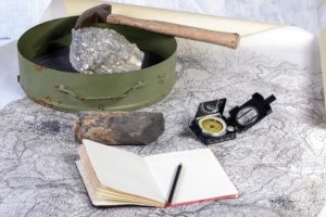
This is an applied science that utilizes many geoscience technologies, GPS and GIS for planning, drone-based photogrammetry, 3D laser scanning, and traditional on-the-ground measurements. Modern mining surveyors spend as much time analyzing data in AutoCAD as they do collecting field measurements.
What Does a Mining Surveyor Do?
Mining surveyors combine traditional surveying techniques with mining-specific knowledge to create accurate maps and measurements for resource extraction. A typical day might involve using GPS equipment to establish control points around a new mine site in the morning, then spending the afternoon in AutoCAD creating 3D models of underground tunnels based on those measurements.
They analyze satellite imagery, historical geological data, and GIS overlays to identify promising exploration areas. Once a site is selected, they conduct ground surveys using total stations, GPS receivers, and 3D laser scanners to create detailed topographic maps. This data feeds into AutoCAD models that show mining engineers exactly where to dig and how deep they can go safely.
The work isn't just about current operations. Mining surveyors assess the viability of proposed mines by measuring potential resource deposits and calculating extraction costs. For existing mines, they determine whether remaining material justifies continued investment or if the mine should close. This requires understanding not only surveying technology but also engineering geology, property law, state mining regulations, and the physical properties of rocks and deposits.
Technology has transformed mining surveying over the past decade. Drones equipped with LiDAR sensors can map an entire surface mine in hours—work that once took weeks. Underground, total stations paired with 3D modeling software create virtual mine maps that help engineers spot potential safety hazards before they become dangerous. Real-time kinematic (RTK) GPS provides centimeter-level accuracy for boundary surveys and reclamation planning.
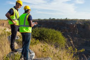
Mining surveyors also design emergency evacuation maps for underground operations and measure ventilation flow throughout mine shafts. They locate utility lines and permanent structures, maintain and calibrate sophisticated surveying instruments, and produce regular reports for stakeholders, management, and regulatory agencies. The role demands both technical expertise and the ability to work in extreme weather conditions on steep slopes and rugged terrain.
Mining Surveyor Work Environment
No specific data exists for mining surveying employment, as this is a specialized niche within the broader surveying field. According to BLS data for all surveyors, over 70% work in architectural and engineering services. The mix of fieldwork and office work means successful mining surveyors need diverse skills related to geoscience and technology.
Here's what many people don't realize: mining surveyors rarely spend all their time outdoors or at a desk. Most split their workweek between field data collection and office-based analysis. In large engineering firms with substantial teams, some positions lean heavily toward one environment or the other, either pure field technicians who focus on measurements or data analysts who interpret them. But most mining surveyors develop competency in both areas.
Government bodies employ approximately 11% of surveyors, though fewer work specifically in mining applications. These professionals typically handle the relationship between mining facilities and public works, highways, government buildings, residential areas, and environmental compliance. Another 8% work in construction, fulfilling similar roles but focusing on private development projects.
The work environment can be demanding. Field sites often feature steep terrain, underground shafts, heavy equipment, and exposure to weather extremes. Safety protocols are extensive, requiring the use of personal protective equipment and adherence to OSHA and MSHA (Mine Safety and Health Administration) regulations. Office work provides a contrast, climate-controlled spaces with high-end computers running specialized software, analyzing data, and producing deliverables for clients and regulatory agencies.
Mining Surveyor Salary & Compensation
According to the BLS, surveyors, a broader occupational category that includes mining surveyors, earned a median annual salary of approximately $72,740 as of May 2024. Mining surveying is a specialized niche within this field, and there are no separate federal wage statistics specifically for mining surveyors.
Entry-level surveyors typically start in the $40,000-$50,000 range, reflecting lower percentile wages. Experienced mining surveyors with Professional Surveyor licenses and specialized expertise in resource extraction can earn $90,000 or more annually, with top earners exceeding $116,000 depending on experience, location, and employer type.
Geographic location significantly impacts earnings. Mining surveyors in states with active mining industries, Wyoming, Nevada, Alaska, West Virginia, and parts of the Mountain West, often command higher salaries due to demand and hazardous duty considerations. Remote site work sometimes includes additional compensation for travel, per diem, and extended rotations (10-14 consecutive days of work with corresponding time off).
Benefits typically include health insurance, retirement plans, paid time off, and support for professional development. Many employers cover the costs of state licensure exams, continuing education requirements, and professional organization memberships. Some positions offer performance bonuses tied to project completion or safety records.
Education Requirements for Mining Surveyors
High school students interested in mining surveying should focus on mathematics (algebra, geometry, trigonometry, calculus), physics, and geography. These foundational subjects prepare you for the rigorous technical coursework ahead.
A bachelor's degree is the standard entry point. Two paths work well: a surveying degree with geology and mining electives, or a geoscience degree with surveying and mathematics coursework. Either way, ABET accreditation is essential. Most states require graduation from an ABET-accredited program to qualify for Professional Surveyor licensure.
Your degree coursework should include GIS technology, AutoCAD and other design software, geodesy, photogrammetry, remote sensing, legal aspects of surveying, and ideally mine-specific applications. Mathematics, through calculus, physics, and geology courses, provides the theoretical foundation. Seek internships with mining companies or engineering firms that serve the mining industry; hands-on experience is invaluable.
Master's degrees enhance career prospects, particularly for those seeking management roles or specialized positions in mine planning and resource estimation. A master's in surveying, geomatics, or mining engineering develops a deeper understanding of complex projects and opens doors to leadership positions. While not required for most surveying jobs, a master's degree can differentiate you in a competitive market where technology reduces the need for entry-level technicians while increasing demand for skilled specialists who can manage advanced systems.
Professional licensure is required in most states. The typical path involves passing the Fundamentals of Surveying (FS) exam after graduation, working under a licensed surveyor for several years (requirements vary by state, typically 2-4 years), then passing the Principles and Practice of Surveying (PS) exam. Once licensed, you can sign and seal surveys, work independently, and supervise junior surveyors.
Doctoral programs suit those entering academia or high-level research positions in government or scientific institutes. A PhD isn't necessary for most mining surveying careers, but it opens opportunities in university teaching, advanced research, or executive advisory roles.
Career Progression for Mining Surveyors
Mining surveying careers typically follow this progression:
Entry-Level Surveyor (0-3 years): Recent graduates work under licensed surveyors, conducting field measurements, operating equipment, and processing data. You'll learn company procedures, mine-specific safety protocols, and gain proficiency with various surveying instruments. Expect to spend considerable time outdoors in challenging conditions while developing your technical skills. This is when you'll prepare for and pass your Professional Surveyor licensing exams.
Professional Surveyor (3-7 years): After obtaining state licensure, you can work independently, lead field crews, and sign off on surveys. This is when specialization deepens; some focus on underground surveying, others on resource estimation, reclamation surveys, or environmental compliance. You'll interface directly with mining engineers, geologists, and project managers, translating field data into actionable information. Salary increases substantially after licensure.
Senior Mining Surveyor/Manager (7+ years): Experienced surveyors manage multiple projects simultaneously, supervise teams of 5-15 people, and make strategic decisions about mine development. You'll contribute to mine planning, safety systems, regulatory compliance strategies, and client relationship management. Many senior surveyors split time between fieldwork oversight and business development. At this level, your geological knowledge, engineering understanding, and project management skills matter as much as your surveying expertise.
Some mining surveyors transition into roles in mine engineering, consulting, project management, or regulatory compliance as their careers progress. Others become independent consultants, particularly in regions with numerous small to mid-sized mining operations. The combination of technical surveying skills and mining industry knowledge creates diverse career opportunities.
Job Outlook & Future Demand
The BLS projects approximately 4% employment growth for surveyors between 2024 and 2034, resulting in roughly 3,900 job openings annually. Many of these openings come from replacement needs as experienced surveyors retire. There are no separate federal projections specifically for mining surveyors, but the broader demand for surveying professionals supports opportunities for those with specialized mining experience.
This moderate growth reflects competing forces in the field. Continued resource extraction needs, mine reclamation requirements, and expanding demand for rare earth minerals used in clean energy technologies all require skilled surveying work. At the same time, technological advancements change how work gets done.
Technology requires fewer personnel to accomplish more work, faster. Drone-based surveys, automated data processing, machine learning algorithms for pattern recognition, and cloud-based project management reduce the labor intensity of surveying operations. A single surveyor with drone equipment and modern software can now accomplish what once required a three-person crew and substantially more time.
However, this doesn't mean there are fewer opportunities for skilled professionals. The technology shift creates demand for surveyors who can operate advanced systems, interpret complex datasets, integrate multiple data sources, and make strategic decisions based on that information. Students who develop expertise in drone operation, LiDAR data processing, GIS analysis, BIM (Building Information Modeling) integration, and programming or scripting for automation will find their skills highly valued.
Mining-specific factors also influence demand. The transition to sustainable mining practices, increased environmental regulation, and the growing need for precise measurements in both active operations and reclamation projects provide steady work for qualified mining surveyors. Aging infrastructure at existing mines requires regular surveys to ensure safety and compliance.
Geographic variation matters significantly. States with active mining industries, particularly those extracting coal, precious metals, industrial minerals, or rare earth elements, will offer more opportunities than regions without natural resource extraction. International opportunities also exist, particularly in developing nations expanding their mining sectors.
Mining Surveyor - Related Degrees
Professional Organizations & Associations
Mining surveyors benefit from involvement in professional organizations that provide continuing education, networking, and industry updates:
International Society for Mine Surveying: This international organization brings together mine surveying specialists from around the world. They maintain permanent membership in the World Mining Congress, organize conferences showcasing the latest technologies and methodologies, and publish technical papers on innovations in mine surveying. Membership provides access to a global network of professionals facing similar challenges.
National Society of Professional Surveyors: While not exclusively for mining surveyors, NSPS is the largest US professional body overseeing all surveying disciplines. They provide guidance on professional standards, advocate for the surveying profession at state and federal levels, offer continuing education programs, and maintain resources on licensing requirements across different states. Most practicing surveyors maintain NSPS membership throughout their careers.
Frequently Asked Questions
What is the difference between a mining surveyor and a regular surveyor?
Mining surveyors specialize in the unique challenges of resource extraction sites. While general surveyors focus on property boundaries, construction sites, and land development, mining surveyors work both above and below ground, dealing with complex 3D mapping of ore bodies, underground tunnel networks, and reclamation planning. They need additional knowledge of geology, mining engineering principles, and mine safety regulations that general surveyors don't typically require.
Do mining surveyors work underground?
Some do, depending on the type of mining operation and their specific role. Underground mine surveyors establish control points in tunnels and shafts, measure excavation progress, and create maps of underground workings. However, many mining surveyors work primarily on surface operations or split their time between surface and underground work. Surface mines, quarries, and open-pit operations provide numerous opportunities that don't involve underground work.
What technology do mining surveyors use?
Modern mining surveyors use GPS receivers (including RTK GPS for centimeter-level accuracy), total stations, 3D laser scanners, drone-mounted cameras and LiDAR sensors, GIS software for spatial analysis, AutoCAD and other CAD programs for mapping, and cloud-based project management platforms. Many also use specialized mining software for resource estimation and mine planning. The technology changes rapidly, making continuous learning essential to staying current.
Is licensure required for mining surveyors?
In most states, yes—surveyors must be licensed as Professional Surveyors (PS or PLS, depending on the state) to sign and seal survey documents, work independently, and supervise other surveyors. Requirements vary by state but typically include graduating from an ABET-accredited program, passing the Fundamentals of Surveying exam, completing 2-4 years of experience under a licensed surveyor, and passing the Principles and Practice of Surveying exam. Some states have additional requirements specific to mining work.
Can mining surveyors work remotely?
Partially. Field data collection requires being physically present at mine sites, often in remote locations. However, data processing, map creation, report writing, and project planning can often be done remotely. Some mining surveyors work on rotation schedules, spending intensive periods on-site collecting data, then returning home to process and analyze it. The pandemic accelerated the adoption of remote collaboration tools, making hybrid work arrangements more common for office-based work.
Key Takeaways
- Specialized Skillset: Mining surveyors combine traditional surveying with mining-specific knowledge of geology, engineering, and resource extraction, requiring a multidisciplinary approach that combines technical expertise and practical field experience.
- Technology-Driven: Modern mining surveying relies heavily on GPS, GIS, drone technology, LiDAR, and AutoCAD for accurate 3D mine mapping, and technological advances are driving demand for tech-savvy specialists who can operate advanced systems.
- ABET Accreditation Required: Surveying degree programs must be ABET-accredited to qualify for professional licensure in most states, making program selection a critical decision for aspiring mining surveyors.
- Moderate Growth Outlook: Employment is projected to grow 4% through 2034, with approximately 3,900 annual job openings, as technology reduces labor needs while increasing demand for skilled professionals to manage complex datasets and advanced surveying systems.
- Field and Office Balance: The role requires both outdoor fieldwork in challenging terrain and indoor data analysis and map creation—successful mining surveyors develop competency in both environments rather than specializing in one.
Ready to launch a career mapping the earth's resources? Explore ABET-accredited surveying and geoscience programs that combine fieldwork with cutting-edge technology.

2024 US Bureau of Labor Statistics salary and job growth figures for surveyors reflect national data for the broader surveying occupation, not school-specific information or mining surveyor specialty data. Conditions in your area may vary. Data accessed February 2026.