Aerial photography involves capturing images of the Earth's surface from aircraft, drones, or other elevated platforms. It's used across environmental science—from tracking climate change and mapping vegetation to archaeological surveys and urban planning. Images are taken either obliquely (at an angle) or vertically (straight down), with each method serving different research needs. When paired with GIS technology, aerial photography becomes a powerful tool for environmental monitoring and landscape analysis.
Aerial photography has transformed how we study and understand our environment. Whether you're a geography student learning to interpret landscape features, an environmental professional tracking ecosystem changes, or exploring careers in geospatial analysis, understanding the principles and applications of aerial photography is essential.
From monitoring coastal erosion to discovering archaeological sites invisible from the ground, aerial photography remains one of the most versatile tools in environmental science—even in our age of satellite imagery and drone technology. This guide covers when to use it, how different techniques work, and why it remains vital across multiple disciplines.
Desk-based research isn't just about reading papers for vital pieces of information or analyzing tables and graphs. For many environmental researchers, primary data is all around us. Aerial photography, for example, is an essential source of information for researchers in landscape studies. This includes disciplines such as Landscape Archaeology (the study of how humans used landscapes in the past), Human Geography (how modern humans utilize the landscape), and climate science (to determine land use and conditions; to track—for example—the growth and retreat of seasonal ice and water levels or invasive flora species).
Anyone can learn how to interpret aerial photographs. If you're an undergraduate in archaeology or geography, you'll likely study them in your first year. It's usually at the master's level that students work extensively with aerial photographs and are expected to produce academic reports or projects that use them in detail. They remain vital to cartographers in producing modern maps, despite the prevalence of electronic methods and satellite imagery, mainly for measuring when compiling them. Aerial photographs are essential to any study of local environmental conditions. They are used in many ways, depending on the type of photograph, the angle at which it was taken, and the elevation of the vehicle used to capture it.
Table of Contents
- What Is Aerial Photography and How Does It Work?
- History of Aerial Photography and Survey
- Modern Technology Integration
- Applications of Aerial Photography
- Career Applications
- Frequently Asked Questions
- Key Takeaways


What Is Aerial Photography and How Does It Work?
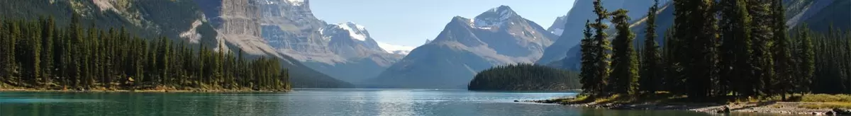
Aerial photography is—as it sounds—the process of taking photographs from the air, but there's more to it than simply using a light aircraft or helicopter and flying up to take pictures. There are many elements of an aerial survey that must be considered to ensure the data is sufficient to support extrapolation of the investigation. It's often difficult to see aspects of the landscape on the ground. Features can easily be missed, and what might seem like an insignificant bump from ground level can become more significant in the broader context. Some landscape types are difficult to access on foot, so aerial photographs are vital for studying and mapping them.
They've been used in landscape studies for over a century, especially in archaeology, and researchers have learned much about the world around us. Its applications today are broad, and coupled with the growing field of GIS (geographic information systems), the potential means the method won't become obsolete anytime soon. Aerial photographs are taken in two basic forms: oblique and vertical. Even today, in an age of high-quality digital imaging, black-and-white images are often preferred in specific applications—partly because they're cheaper and partly because the contrast between black, white, and grey makes it easier to pick out features. However, digital multispectral imaging now dominates many environmental monitoring applications due to its ability to capture data across multiple wavelengths simultaneously.
Oblique Photography
These images are usually taken at an angle, typically 45 degrees. Still, because they're often taken manually, they can be taken at any angle that gives the best view of the feature or landscape. The oblique image is primarily used in archaeology to capture the broader context of a feature and the surrounding area, and to provide depth. Nearly always taken at a much lower elevation than the vertical image and in small numbers, it is used more specialized and often for a specific purpose.
There's a problem with perspective: the farther away a feature is, the smaller it appears. Nearer objects of comparable size appear larger than those farther away. Hence, it's often best to take a selection or use a ground-based frame of reference for perspective. These images are taken from small fixed-wing aircraft and helicopters. They are ideally suited to monitoring the erosion of features and monuments throughout the year and over many decades.
When to Take Oblique Photographs
The time of year is vital, and many see winter as the perfect season to take aerial photographs. There are many reasons for this, not least that it's easier to see features in fields that don't have crops and won't be plowed for several more months. Surviving features beneath the surface will often appear darker due to the shallower soil.
Snowy, frosty conditions perfectly emphasize ridges and features, and they can be photographed with a clarity not seen at any other time of year. The low angle at which the sun rises casts much longer shadows, making it much easier to spot above-ground features. The perfect example here is the relic medieval ridge-and-furrow features.
That's not to say that the warmer months and longer hours of light aren't conducive to aerial photography. If there are stone remains beneath the surface, crops will grow shallower as they can't put down as much root, and features will show up as crop marks. Late evening conditions also cast longer shadows, and the differing light levels between morning, afternoon, and evening can add depth when comparing multiple images of the same feature over the course of a day.
Vertical Photography
Taking a photograph straight down over a landscape is the more familiar form of aerial photography. It's a plan view, so there's no perspective to distort the image. This also means it's difficult to read the lay of the land, such as changes in height, though there's a workaround: use a device to view two images at once. This usually gives a good impression of the variation in land elevation.
They're taken at regular heights for consistency, so it's easier to compare landscapes taken on the same day or many years apart to examine development. Rarely used in archaeological applications except perhaps sometimes to find interesting earthworks and other sites that are easily missed on the ground, they cover a much wider area and focus on topography rather than specific details.
When to Take Vertical Photographs
As a rule, vertical aerial photographs are easier to interpret than oblique photographs because of the standardized ways in which they're taken—with set scales and at a single non-arbitrary angle. The same advantages generally apply to vertical as to oblique, but you'll lack the perspective, depth, and 3D effect even with the weather conditions mentioned above. At higher levels, you may miss crop and soil marks. If you require an overview, vertical photography is the best way to go.
Oblique vs. Vertical: Quick Comparison
| Feature | Oblique Photography | Vertical Photography |
|---|---|---|
| Angle | 45 degrees or angled view | Straight down (plan view) |
| Perspective | Provides depth and 3D context | No perspective distortion |
| Best For | Specific features, archaeological sites, and monitoring erosion | Mapping, topography, large area coverage |
| Elevation | Lower altitude, fewer images | Higher altitude, systematic coverage |
| Measurement | Difficult due to perspective | Accurate measurements possible |
| Typical Use | Archaeology, site documentation | Cartography, land use planning |
History of Aerial Photography and Survey
The first aerial photograph was an oblique view of a French village taken in 1858. The man who brought it—photographer Gaspard-Félix Tournachon (known as Nadar)—patented the concept of using aerial photographs to compile maps. It was to prove much more effective than the time-consuming ground surveys that had then been the most commonly used method of national mapping organizations that developed throughout the 19th century (such as the UK's Ordnance Survey).
George R. Lawrence took aerial photographs of San Francisco in 1906 after the devastating earthquake. Still, it wasn't until World War I—when military applications were anticipated—that a systematic process of aerial photography became key to its development.
Archaeologist OGS Crawford pioneered the use of aerial photography for this purpose after seeing its potential for studying the English landscape. Germany had more advanced aerial reconnaissance at the outset of WWI. Still, systematic aerial photography grew rapidly on both sides, as the Allies and the Germans regularly photographed each other's lines and resources to keep up to date on enemy movements. Having experienced the success of this method of observation, Britain once again used aerial photography during World War II, employing teams of archaeologists to interpret large numbers of photographs taken for aerial reconnaissance. After the war, researchers welcomed the beginning of the modern movement in landscape studies, which treated the landscape as a feature and a monument in itself, encompassing natural processes and archaeological features.
With the advent of satellite imagery produced by national and international space agencies, military aerial reconnaissance shifted to work alongside satellite methods, with each serving complementary roles based on resolution and operational needs.
The Cold War era saw both color and infrared photography develop in parallel for different applications. By the 1960s and 1970s, color film use in military aerial photography had become more widespread, and it was during this period that wider environmental applications also developed. Infrared photography has been used since the mid-20th century for vegetation mapping and also for tracking and identifying diseased plants and trees. The ability to take landscape photographs across the full spectrum of colors opened up a wide range of applications across the broadest possible scope of environments.
Better cameras were developed, and both the USA and the USSR were able to plan reconnaissance flights over key sites from thousands of feet above. It was then that satellite reconnaissance began to take over.
Since then, aerial photography has been used extensively in archaeological studies and later in wider environmental studies, including mapping forests and vegetation changes over time, tracking changes in river direction and depth, planning conservation work for river systems, and documenting landscape changes after natural processes such as landslides. Its applications are limitless with multiple functions in geology, geography, and broader landscape, rural, and urban studies. It's a cheap and effective remote sensing method. Even today, with widely available satellite imagery and public mapping such as Google Earth, aerial photography remains vital to landscape and other environmental studies. It adapts as technology and human needs adapt.
Modern Technology Integration
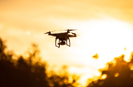
The field has evolved dramatically with drone (UAV) technology, making aerial photography more accessible and affordable than ever before. Environmental researchers can now capture high-resolution images on demand, while AI-powered image analysis helps identify patterns human observers might miss.
Today's aerial photography integrates seamlessly with modern geospatial tools. GIS technicians and analysts process aerial imagery using software such as ArcGIS Pro and QGIS, creating detailed maps and spatial databases. This combination of traditional photography methods with cutting-edge technology has expanded what's possible in environmental monitoring.
Modern applications include:
- Drone Surveys: Low-cost, flexible image capture for small to medium areas using platforms like DJI or senseFly systems. Researchers can now capture imagery more flexibly than with traditional aircraft, though flight planning, regulatory compliance, and data processing still require significant time investment.
- Multispectral Imaging: Tracks plant health, water quality, and soil conditions by capturing data across multiple wavelengths using sensors like MicaSense or Parrot Sequoia. This technology reveals environmental stresses invisible to the naked eye.
- LiDAR Integration: Combines aerial photography with laser scanning to create 3D landscape models using software such as ArcGIS Pro and QGIS, and specialized tools like Pix4D, which is particularly useful for mapping terrain beneath forest canopies.
- AI Analysis: Machine learning algorithms in platforms like ENVI, ArcGIS Image Analyst, and Google Earth Engine identify features, track changes over time, and process thousands of images in minutes—work that once took researchers months to complete.
- Real-Time Monitoring: Live feeds support disaster response, environmental emergencies, and immediate decision-making for conservation efforts.
Applications of Aerial Photography
In Archaeology
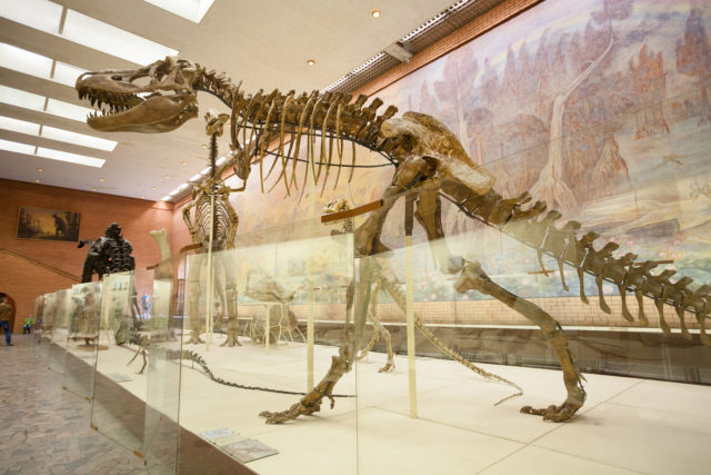
As discussed earlier, in archaeology, aerial photography is ideal for locating lost monuments and tracking features, especially those that aren't visible at ground level, those that are buried and can't be seen on a field walk, and those that can only be seen under certain conditions. Archaeologists use aerial photography extensively to discover and document sites that would otherwise remain hidden.
They're usually discovered through any of the following:
Crop Marks and Parch Marks: Seen in summer, crop marks are signs of subterranean features that appear as irregularities in crop patterns. Crop growth might be stunted by existing remains, such as stone foundations, or it might be higher than surrounding crops due to underlying water systems, such as dried-up drainage channels or long-gone artificial water features, such as fishponds. Parch marks occur in arid summer areas. In some conditions, the crop may be a different color. Parch marks are discolorations in the crop caused by prolonged drought—areas where groundwater dries up quickly, and places where there may be more groundwater will show up clearly. Caution is advised when interpreting both crop marks and parch marks, as the anomalies may be archaeological, geological, or due to variations in soil and groundwater courses. Modern pipes may also flag a false positive for features of interest.
Soil Marks: Best studied in winter, when no crops are growing, or grasses have died, mainly off; both rainy and dry conditions are conducive to picking out buried features. Typically appearing as darker areas, they can indicate underlying stonework, the outlines of prehistoric features such as barrows and cursus monuments, and ditches. The same issues above apply—they could be natural or modern features.
Low-Profile Monuments: From the ground, they may seem like natural bumps or be so slight as to be barely perceptible. From the air, their appearance is far more revealing. On their own, they may not look substantial, but when accompanied by the above, they can appear more significant.
In Urban Studies
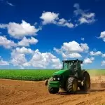
Urban development and the history of urbanism are a growing niche within landscape studies, with a wide range of applications across history and archaeology, the history of cartography, the history of commerce, sociology, and even modern urban planning. Town developers need to study the effects of urban center expansion and development on the landscape and the environment. Urban planners rely on aerial surveys to assess existing infrastructure and plan future development.
New facilities (for example, a new sports stadium) will require a rethink of the infrastructure and the impact that the new facility will have on people living in the area—will we need to build more houses? Upgrade the roads? Will this affect protected areas? Aerial photography taken at low levels is vital to examining the existing infrastructure.
In Climate Change Research
We all know about the effects of climate change on global temperatures. These global changes are evident everywhere, and societies and communities are experiencing changes in their local environments. If it isn't riverbeds drying up, droughts getting longer, wetter seasons getting wetter, and inland lakes drying up completely, one of the most practical applications is tracking invasive species into water bodies that, just a few years ago, wouldn't have provided an adequate environment for those species.
Researchers keep vital records of seasonal and annual changes to track the local effects of climate change and the risks to local ecosystems. Localized aerial photographs highlight the die-off of certain vegetation or the increase of invasive species.
In Other Earth Sciences
They can also be used to study natural processes, such as variations in soil and geology over time, as well as changes in the underlying ground that lead to disasters such as landslides. Used less frequently in geology today due to the rise of satellite and geophysical methods, aerial survey nevertheless has uses and benefits, and the historical record for changes to the natural landscape is vital to understanding how the landscape may change in the future.
Annual rainfall, whether lower or higher than usual, can have far-reaching consequences, and this is where geology's interest in aerial photography is most important.
Though increasingly supplanted by satellite imagery and GIS-based digital mapping in recent years, photogeology still has practical applications in finding mineral and fuel deposits, mapping areas, tracking geological changes, water management, and general geological research that other applications can't address. A great example of this is the drainage of water ahead of proposed new urban developments—floodplain risks and subsidence.
Career Applications
Understanding aerial photography opens doors to careers in environmental science. Whether you're just starting to explore environmental programs or planning your specialization, knowing how aerial photography fits into professional practice can help guide your educational choices.
GIS and Mapping: Cartographers and GIS technicians use aerial imagery daily to produce maps and conduct spatial analysis. The combination of aerial photography skills with GIS software proficiency is highly valued in the job market. Modern mapping projects integrate aerial photographs with GPS data, satellite imagery, and field surveys to create comprehensive geographic databases.
Environmental Consulting: Consultants assess site conditions, track habitat changes, and document environmental impacts using aerial surveys—skills central to environmental impact assessments. Whether evaluating wetland boundaries, monitoring restoration projects, or documenting pre-development conditions, aerial photography provides the visual evidence needed for regulatory compliance and project planning.
Archaeology and Cultural Resources: Archaeological surveys rely heavily on aerial photography to locate sites, document features, and plan excavations. Many archaeology positions specifically list aerial photo interpretation as a required skill. The ability to recognize subtle landscape features from aerial views often determines whether important sites are discovered before development occurs.
Urban and Regional Planning: Planners use aerial imagery to assess land use, plan infrastructure, and evaluate development impacts. Understanding how to interpret aerial photographs is essential for comprehensive planning work. From analyzing traffic patterns to assessing the distribution of green space, aerial photography provides the bird's-eye view planners need for effective decision-making.
Conservation and Wildlife Management: Tracking vegetation changes, mapping habitats, and monitoring protected areas all depend on aerial photography—making it crucial for conservation biologists and wildlife managers. Aerial surveys help researchers count animal populations, map migration corridors, and assess habitat quality across large landscapes.
If you're considering careers in these fields, coursework in aerial photo interpretation—typically offered in geospatial degrees, geography, archaeology, and environmental science programs—provides valuable foundational skills. Most programs introduce the basics at the undergraduate level, with more advanced applications taught in graduate coursework. Geographers in particular develop extensive aerial interpretation skills throughout their training.
Frequently Asked Questions
What's the difference between oblique and vertical aerial photography?
Oblique photography is taken at an angle (typically 45 degrees), providing depth and context ideal for studying specific features. Vertical photography is shot straight down, offering a plan view without perspective distortion, making it better for mapmaking and measuring areas accurately. Each method serves different research needs—oblique for detailed site documentation, vertical for systematic surveys and mapping.
How is aerial photography different from satellite imagery?
Aerial photography is taken from aircraft or drones at lower altitudes (typically a few hundred to several thousand feet), providing higher resolution and more flexibility in timing and angles. Satellite imagery covers larger areas but with less detail and fixed schedules. Many projects use both methods together—satellites for regional context and aerial photography for detailed local analysis.
What careers use aerial photography?
Cartographers, GIS technicians, archaeologists, urban planners, environmental scientists, and geographers all use aerial photography regularly. It's also essential for environmental consultants, conservation biologists, and climate researchers tracking landscape changes over time. The skill is particularly valuable in geospatial careers where visual analysis of terrain and features is central to the work.
Do I need special training to interpret aerial photographs?
Basic interpretation can be learned quickly—undergraduate geography and archaeology students typically study it in their first year. However, advanced analysis for professional applications requires practice and often involves training in GIS software. Most master's programs include extensive coursework in aerial photo interpretation. The learning curve isn't steep for fundamentals, but professional-level expertise takes time to develop.
Is aerial photography still relevant with modern drones and satellites?
Yes. While drones and satellites have expanded our options, traditional aerial photography from aircraft still offers unique advantages: consistent image quality, proven methodologies, and the ability to efficiently cover medium-sized areas. Many professionals use all three methods depending on project needs. Drones excel at small areas, satellites at continental scales, and traditional aerial photography fills the crucial middle ground.
Key Takeaways
- Two Main Types: Oblique photography (angled) provides depth for specific features; vertical photography (straight down) offers measurable plan views for mapping. Each serves different purposes in environmental research.
- Cross-Disciplinary Tool: Aerial photography is essential in archaeology, urban planning, climate science, conservation, and geology, making it valuable across diverse environmental careers. Understanding its applications helps you see how different specializations connect.
- Timing Matters: Winter conditions (snow, frost, low sun angles) often reveal features invisibleat other times of year, while summer crop marks indicate buried structures. Knowing when to capture images is as important as knowing how.
- Modern Integration: When combined with GIS, drone technology, and AI, aerial photography becomes even more potent for environmental monitoring and analysis. The field continues to evolve with new tools while maintaining core principles.
- Career Pathways: Understanding aerial photography interpretation is foundational training for cartographers, GIS technicians, environmental consultants, and geospatial analysts. Many environmental science programs include this skill in their curriculum.
Interested in careers that use aerial photography and geospatial analysis? Explore degree programs in environmental science, geography, GIS, and archaeology that can prepare you for this exciting field.
- What Is Parasitology? The Science of Parasites Explained - November 19, 2018
- Desert Ecosystems: Types, Ecology, and Global Importance - November 19, 2018
- Conservation: History and Future - September 14, 2018
Related Articles


Featured Article
What is Paleontology? Degrees, Careers & Impact