A remote sensing specialist collects and analyzes Earth surface data using satellite imagery, LiDAR, and aerial sensors without physical contact. These geospatial professionals support environmental monitoring, urban planning, agriculture, and disaster management by processing complex spatial data. Most positions require a bachelor's degree in geography, environmental science, or GIS, with median salaries around $80,060 as of 2024.
Welcome to one of the most dynamic and growing fields in environmental science. If you're considering a career that combines cutting-edge technology with environmental stewardship, remote sensing offers a compelling pathway. This guide will help you understand what remote sensing specialists do, what education you'll need, and whether this career aligns with your interests and goals.
What Is Remote Sensing?
Remote sensing involves collecting information about places or objects on the Earth's surface from a distance. Specialists in this area may use air or satellite imagery based on visible light. Or they may use "false images" showing how the Earth reflects microwave, infrared, or thermal energy. The colors in these "false images" indicate different absorption and reflection patterns, revealing information on the shape, size, elevation, or composition of an object or area on the ground.
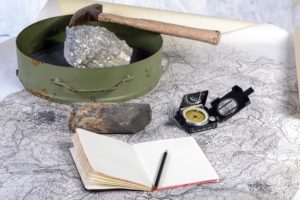
LiDAR is similar to sonar, but it uses lasers. LiDAR involves shooting lasers toward the ground and measuring how much of the beam is reflected. This highly sensitive technique is used to determine elevation, even creating detailed, pointillistic "reconstructions" of forests based on the elevations and positions of branches, leaves, and tree trunks. Similarly, imaging radar systems create images of objects by analyzing the portion of the radar signals returned. Archaeologists use ground-penetrating radar to investigate, map, and assess archaeological sites.
Hyperspectral remote sensing collects information across many narrow electromagnetic bands simultaneously for every pixel in an "image". Given its exceptionally high resolution, efficiency, and detection effectiveness, this is a burgeoning and promising area of research and development.
Remote sensors are often integrated with satellites. The National Aeronautics and Space Administration (NASA) studies Earth and space for this reason. NASA's Earth Observing System (EOS) recently launched a new suite of satellite-based sensors. NASA uses data collected by its satellites to monitor, analyze, and understand natural hazards and human impacts on Earth's surface. The data collected contributes to the study of climate change, air pollution, and other environmental challenges. You can even get free satellite-based imagery and maps from NASA's Earth Observatory.
What Does a Remote Sensing Specialist Do?
Remote sensing specialists support scientists by designing and conducting remote sensing data gathering efforts. For example, they determine the best techniques, equipment, spectral band, and time of day for a particular mission. They may prepare flight plans, configure sensors, apply field-collecting techniques, and process the resulting data.
On a typical day, a remote sensing specialist might start by reviewing satellite imagery for a forestry project, then spend the afternoon calibrating sensors for an upcoming aerial survey. They often work collaboratively with GIS specialists, environmental scientists, and urban planners to integrate remotely sensed data into broader analytical frameworks.
This data is used across a wide range of fields, including the environmental sciences, agriculture, archaeology, urban planning, water management, meteorology, and even engineering and business.
However, before it can be used, remote sensing specialists must verify the integrity and accuracy of the data and correct any errors caused by atmospheric variations or other interference. They may also build photo mosaics of large areas, participate in the planning or development of mapping projects, and integrate remotely sensed data with other geospatial data to create maps. Many use programming languages such as Python to automate data processing tasks. They may also develop metadata that documents the datasets so that others will understand their context and characteristics.
Where Does a Remote Sensing Specialist Work?
Remote sensing is growing by leaps and bounds, and careers in the field are available in all states and throughout the private, public, government, and academic sectors. Remote sensing specialists may be hired as geographers, cartographers, physical scientists, computer scientists, GIS analysts, remote sensing scientists, surveyors, photogrammetrists (who create maps from air and satellite photos), image analysts, or other professionals.
Federal and state planning, environmental, land management, and transportation agencies offer many job opportunities in this area. Many are employed as geospatial analysts at federal defense agencies such as the Central Intelligence Agency and the Department of Defense.
Remote sensing is increasingly used by private companies that sell imagery and data to Google, Bing, the federal government, scientists, academic and research libraries, and others. Specialists may also find employment at consulting firms, software development firms, and scientific laboratories, where they are expected to improve technologies, software, or data analysis techniques.
Some specialists become professors or research staff in academia. These positions require at least a master's degree, while tenured faculty have doctoral degrees.
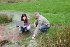
Most specialists in this highly computerized field spend much, if not all, of their time in office environments. However, collecting or verifying field data may be required on occasion.
Remote Sensing Specialist Salary & Compensation
Salary expectations for remote sensing specialists vary based on experience, education, industry, and geographic location. As of May 2024, the Bureau of Labor Statistics reports that environmental scientists and specialists, including health professionals in related fields like remote sensing, earned a median annual wage of $80,060.
The salary range shows significant variation based on experience and specialization. The lowest 10 percent earned less than $50,130, while the highest 10 percent earned more than $134,830. Most remote sensing specialists fall somewhere in the middle, with opportunities for advancement as they gain expertise.
| Experience Level | Typical Salary Range | Years of Experience |
|---|---|---|
| Entry-Level Analyst | $50,000 - $65,000 | 0-2 years |
| Mid-Level Specialist | $70,000 - $90,000 | 3-7 years |
| Senior Specialist | $95,000 - $120,000 | 8-15 years |
| Lead/Principal Specialist | $115,000 - $135,000+ | 15+ years |
Federal government positions often provide comprehensive benefits packages including health insurance, retirement contributions, and job stability. Many remote sensing specialists working for agencies like NASA, NOAA, or the USGS enjoy generous vacation time, opportunities for continued education, and pension benefits. Private sector positions may offer stock options, performance bonuses, and flexible work arrangements, including remote work options for data analysis tasks.
Remote Sensing Specialist Jobs
Remote sensing specialist careers improve, enhance, and update the data that many companies and governments use for research and to improve the quality of life. While the role varies significantly across industries and organizations, most remote sensing specialists perform similar core functions.
Data Collection and Analysis: Specialists read and respond to scientific and technical literature to stay current in the field. They operate remote sensing equipment to gather airborne, ground-based, and satellite data, ensuring that the data obtained from these systems meets quality assurance guidelines. They're responsible for verifying data integrity and correcting errors caused by atmospheric variations or interference.
Technical Documentation and Reporting: Much of the work involves preparing images, graphic reports, maps, and charts for internal and external stakeholders. Specialists build large-scale photos of areas like cities and parks, and create metadata that documents datasets so others can understand their context and characteristics. They may use computer modeling to gather data and test hypotheses.
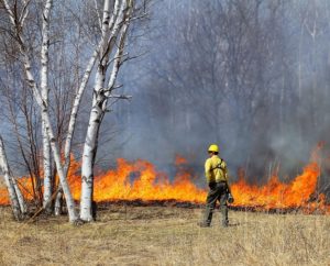
Project Support and Collaboration: Remote sensing specialists work closely with scientists, engineers, and urban planners. They assist with data collection and management during natural disasters such as floods, fires, earthquakes, oil spills, and hurricanes. They must be aware of regulatory and privacy concerns across different locations and ensure that customers have the best possible experience with location products.
Senior-Level Responsibilities: Senior remote sensing specialists often take on extended management responsibilities. They foster positive, safe work environments among colleagues and teams, develop and inform project scopes, schedules, and budgets, and navigate federal and international protocols, regulations, and best practices. They oversee equipment and instrument calibration, prepare proposals for funding and business purposes, ensure quality assurance and the organization of field data, and supervise fieldwork for multiple field crews. They communicate with stakeholders through field status reports and team findings presentations.
Job Outlook & Growth
The outlook for remote sensing specialists remains strong as organizations increasingly rely on geospatial data for decision-making. The U.S. Bureau of Labor Statistics projects employment in the field to grow at a rate of 4 percent between 2024 and 2034, about as fast as the average for all occupations. This growth translates into approximately 8,500 job openings per year on average over the decade, many of which result from the need to replace workers who retire or transition to other occupations.
Federal Agencies Hiring Remote Sensing Specialists: Major federal employers include NASA (Earth science missions and climate monitoring), the National Oceanic and Atmospheric Administration (NOAA) for weather and ocean observation, the U.S. Geological Survey (USGS) for land cover mapping and natural resource management, the Department of Defense and intelligence agencies for national security applications, and the Environmental Protection Agency for environmental monitoring and compliance.
Private Sector Opportunities: The commercial remote sensing industry is expanding rapidly. Companies like Maxar Technologies, Planet Labs, and Esri provide satellite imagery and geospatial analytics to various clients. Tech giants, including Google, Microsoft, and Amazon, increasingly employ remote sensing specialists for mapping services and cloud-based geospatial platforms. Environmental consulting firms and engineering companies also hire specialists for project-based work.
Emerging Trends Driving Demand: New developments are boosting commercial applications and creating specialized job opportunities. High-resolution sensors and sensors that can be directed from the ground are expanding possibilities. The integration of artificial intelligence and machine learning is revolutionizing data processing and analysis. Climate change monitoring requires ongoing Earth observation and trend analysis. Disaster response and recovery efforts increasingly rely on rapid satellite assessment. Urban planning and innovative city initiatives depend on detailed geospatial data for infrastructure development.
Education & Training Requirements
While most remote sensing specialists have a bachelor's degree, those who prefer not to pursue a 4-year degree can find entry-level employment after completing an associate's degree or certificate program in photogrammetry, surveying, or GIS.
Geography programs typically offer remote sensing classes. Those drawn to this field may decide to major in geography. However, since remote sensing tools support a wide variety of disciplines, classes may also be offered as part of engineering, forestry, geology, or environmental science programs. Many schools now provide minors, certificates, and master's programs in remote sensing and other geospatial technologies.
| Degree Level | Typical Roles | Time to Complete | Best For |
|---|---|---|---|
| Associate's Degree or Certificate | GIS Technician, Entry-level Data Analyst | 1-2 years | Quick entry to field, technical support roles |
| Bachelor's Degree | Remote Sensing Specialist, Geospatial Analyst | 4 years | Most professional positions, government work |
| Master's Degree | Senior Specialist, Research Scientist, Consultant | 2 years | Specialization, research, and advancement opportunities |
| PhD | Professor, Research Director, Chief Scientist | 4-6 years | Academia, advanced research, and leadership positions |
However, within the earth and environmental sciences, these offerings generally enhance scientists' skills and credibility rather than standing on their own. For this reason, those interested in applying remote sensing techniques to environmental issues would be wise to develop a broad background in environmental science, forestry, geology, and related fields, as well as in math and computer programming.
Consider what matters to you: Are you more interested in the technical data processing side or applying remote sensing to solve environmental problems? Do you see yourself working in government, private industry, or academia? Your answers will help guide your educational path and specialization choices.
Strong programs in remote sensing and geospatial sciences can be found at institutions such as Penn State University (John A. Dutton e-Education Institute), the University of Maryland (Department of Geographical Sciences), and the University of California, Santa Barbara (Department of Geography). Many programs now offer online or hybrid options for working professionals.
While demand is high, employers seek candidates with practical experience in addition to education. It's essential to seek out opportunities to gain experience as early as possible. This may mean participating in an internship or volunteering for nonprofit organizations to build up a portfolio. A solid portfolio, experience, and knowledge of computer programming are key to being competitive in the job market.
Other Degrees Related to Remote Sensing
Skills & Qualifications
Success as a remote sensing specialist requires a combination of technical proficiency, analytical thinking, and communication abilities. Here are the essential skills employers look for:
Technical Skills: Programming languages like Python and R are increasingly essential for automating data processing and analysis. Familiarity with remote sensing software such as ENVI, ERDAS IMAGINE, or eCognition is expected. Proficiency in geographic information systems (GIS) platforms like ArcGIS Pro, QGIS, or Google Earth Engine is fundamental to the role. An understanding of statistics and spatial analysis methods helps specialists interpret data accurately. Knowledge of image processing techniques, including classification, change detection, and spectral analysis, is crucial.
Analytical and Problem-Solving Skills: Remote sensing specialists must interpret complex datasets and identify patterns or anomalies. They need strong attention to detail when verifying data quality and correcting errors. Critical thinking helps them select appropriate sensors, methods, and analysis techniques for specific projects. The ability to troubleshoot technical issues with sensors, software, or data collection processes is valuable.
Communication and Collaboration: Specialists must explain technical concepts to non-technical stakeholders through clear reports and presentations. Collaborate with scientists, engineers, planners, and policymakers across disciplines. Writing skills are essential for creating metadata documentation, technical reports, and research papers. Presentation abilities help when sharing findings at conferences or in client meetings.
Domain Knowledge: Depending on the application area, specialists benefit from an understanding of atmospheric science, ecology, geology, urban planning, or other relevant fields. Knowledge of satellite systems, sensor characteristics, and orbital mechanics provides essential context. Awareness of regulatory requirements, data privacy concerns, and ethical considerations in geospatial data use is increasingly important.
Career Paths & Advancement
Remote sensing offers clear pathways for career growth, with opportunities to advance into technical leadership, management, or specialized research roles.
Entry Level (0-2 years): Most graduates start as junior analysts or technicians, focusing on data processing, quality control, and supporting senior specialists. This stage involves mastering software tools, understanding standard procedures, and learning project workflows. Typical titles include Remote Sensing Technician, GIS Analyst I, or Junior Geospatial Analyst.
Mid-Career (3-7 years): With experience, specialists take on more complex analysis projects, begin developing methodologies, and may supervise junior staff. They often specialize in particular applications (forestry, urban planning, disaster response) or technologies (LiDAR, hyperspectral imaging). Titles at this level include Remote Sensing Specialist, Geospatial Analyst II, or Senior GIS Specialist.
Senior Level (8-15 years): Senior specialists lead major projects, design data collection strategies, and mentor teams. They often contribute to proposal writing, represent their organizations at conferences, and may publish research findings—some transition into consulting roles. Typical titles include Senior Remote Sensing Scientist, Lead Geospatial Analyst, or Principal Specialist.
Leadership Positions (15+ years): The most experienced professionals move into management, overseeing departments or programs. Others become chief scientists, directing research agendas. In academia, this might mean tenure-track professor positions. Consulting firms may promote specialists to partner or director roles. Some launch their own geospatial consulting businesses.
| Role | Primary Focus | Common Tools | Median Salary (2024) |
|---|---|---|---|
| Remote Sensing Specialist | Satellite/aerial data collection and analysis | ENVI, LiDAR systems, Python | $80,060 |
| GIS Specialist | Spatial data management and mapping | ArcGIS, QGIS, SQL databases | $61,880 |
| Photogrammetrist | Creating maps from aerial imagery | Photogrammetry software, surveying equipment | $50,440 |
| Geographer | Spatial patterns and geographic analysis | GIS + remote sensing, statistical software | $90,880 |
Alternative Career Paths: Remote sensing skills transfer well to related fields. Some specialists transition into data science roles focused on spatial analytics. Others move into environmental consulting, urban and regional planning, or natural resource management. The combination of technical and eecologicalknowledge opens doors across sectors.
Professional Organizations & Societies
- The American Society for Photogrammetry and Remote Sensing (ASPRS) is a professional association for the geospatial industry. It offers several types of professional certifications. While optional, these certifications enhance professional credentials and set job seekers apart in a competitive market. It holds annual and specialty conferences, supports divisions, and offers networking opportunities through national job fairs, workshops, and social activities.
- The National States Geographic Information Council (NSGIC) is primarily comprised of management-level geospatial specialists, many of whom coordinate state activities. However, any geospatial specialist is welcome to join. NSGIC is an excellent way to hear about other members' new initiatives and learn through peer-to-peer mentoring.
- The University Consortium for Geographic Information Science (UCGIS) is an association of over 60 universities that advances research and education in geospatial technologies. It facilitates networking through conferences and provides employees of member institutions with timely information on grants and contracts in the field. Its workshops are open to non-members for a fee.
Frequently Asked Questions
Can you work remotely as a remote sensing specialist?
Yes, many remote sensing specialists enjoy flexible work arrangements, especially for data analysis tasks. While fieldwork for sensor calibration or ground truthing requires on-site presence, much of the daily work—processing satellite imagery, running analyses, creating reports—can be done from anywhere with adequate computing resources and internet connectivity. The COVID-19 pandemic accelerated the adoption of remote work in this field, with many organizations now offering hybrid or fully remote positions for experienced specialists.
Do I need a PhD for remote sensing?
No, most remote sensing specialist positions require only a bachelor's degree, though many professionals advance to a master's degree. A PhD is primarily necessary if you want to pursue academic research, become a university professor, or lead advanced research programs at agencies like NASA or NOAA. The majority of industry and government positions value practical experience and technical skills over doctoral credentials. Focus on building your portfolio and gaining hands-on experience with sensors and software, rather than on the platform.
What's the difference between a remote sensing specialist and a GIS specialist?
While there's significant overlap, remote sensing specialists focus primarily on acquiring and processing imagery from satellites, aircraft, or drones, emphasizing sensor operation, image correction, and data extraction. GIS specialists concentrate on managing, analyzing, and visualizing spatial data from various sources, including remote sensing outputs. Remote sensing specialists often feed their processed data into GIS systems. Many professionals develop skills in both areas, and job descriptions frequently blend these roles, especially in smaller organizations.
Is remote sensing a promising career in 2026?
Yes, remote sensing offers strong career prospects with steady 4% growth projected through 2034, competitive salaries (median $80,060), and increasing demand across sectors. Climate change monitoring, disaster response, urban planning, and precision agriculture all drive the continued need for remote sensing expertise. The integration of AI and machine learning is creating exciting new opportunities rather than eliminating jobs, as specialists who understand both the technology and domain applications remain essential. Job satisfaction tends to be high given the meaningful work addressing environmental and societal challenges.
What software do remote sensing specialists use daily?
Most specialists work regularly with ENVI or ERDAS IMAGINE for image processing and analysis. ArcGIS Pro or QGIS serves as the primary GIS platform for spatial analysis and mapping. Python (with libraries like NumPy, Pandas, Rasterio, and GDAL) is increasingly essential for automating workflows. Google Earth Engine has become popular for large-scale analysis using cloud computing. Specialists may also use specialized tools like LAStools for LiDAR processing, eCognition for object-based image analysis, or SNAP for specific satellite sensors. The exact toolkit varies by industry and project requirements.
Key Takeaways
- Strong Career Outlook: Remote sensing specialists earn a median salary of $80,060 with 4% job growth projected through 2034, translating to 8,500 annual openings across federal agencies, private companies, and research institutions.
- Accessible Entry Points: While most positions require a bachelor's degree in geography, environmental science, or GIS, associate degrees and certificates can lead to entry-level technician roles, with clear pathways for advancement through experience and additional education.
- Diverse Applications: Specialists work across environmental monitoring, urban planning, agriculture, disaster response, and national security, using satellite imagery, LiDAR, and hyperspectral sensors to solve real-world problems.
- Essential Technical Skills: Success requires proficiency in remote sensing software (ENVI, ERDAS), GIS platforms (ArcGIS, QGIS), and programming languages (Python, R) for automating ata processing and aanalysis
- Work Flexibility: Many positions offer remote work options for data analysis tasks, though some fieldwork for sensor calibration and ground truthing may be required, providing a balance between office and outdoor work environments.


Ready to explore remote sensing programs? Discover degree options that combine your passion for environmental science with cutting-edge spatial technology and data analysis skills.
2024 US Bureau of Labor Statistics salary and job growth figures for Environmental Scientists and Specialists reflect state and national data, not school-specific information. Conditions in your area may vary. Data accessed January 2026.