
Geographic Information Systems (GIS) help environmental microbiologists track disease outbreaks, map microbial distribution patterns, and predict pathogen behavior across landscapes. This spatial technology transforms complex data into visual patterns that guide public health decisions, conservation strategies, and climate research. Combining microbiology expertise with GIS skills opens career paths in epidemiology, environmental consulting, government agencies, and ecological research.
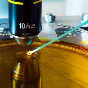
If you're passionate about environmental science and fascinated by the microscopic world, GIS technology might be your secret weapon. Environmental microbiologists study viruses, bacteria, algae, fungi, and parasites—organisms too small to see but with profound effects on ecosystems and human health. When you combine microbiology expertise with Geographic Information Systems, you gain powerful tools to understand how these microorganisms spread, where they thrive, and how environmental changes affect them.
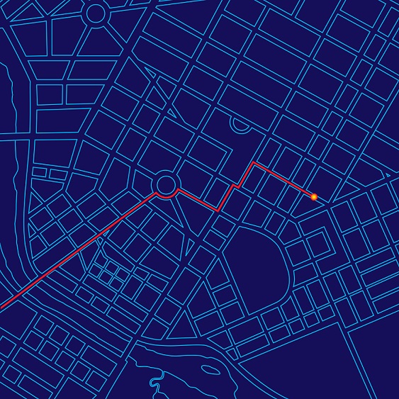
Here's what makes this combination valuable: while traditional microbiology focuses on the organisms themselves, environmental microbiology examines their relationship with the wider environment. GIS adds the critical element of spatial analysis—helping you visualize patterns across neighborhoods, regions, or entire continents. Whether you're tracking disease outbreaks, mapping crop pathogens, or reconstructing ancient ecosystems, GIS transforms raw data into actionable insights.
Table of Contents
- Why Environmental Microbiologists Need GIS
- Tracking Disease Spread with GIS
- Mapping Agricultural Pathogens and Climate Change
- GIS in Paleoenvironmental Research
- Adding GIS Skills to Your Microbiology Degree
- Career Paths: Environmental Microbiology + GIS
- Salary and Job Outlook
- Frequently Asked Questions
- Key Takeaways
Why Environmental Microbiologists Need GIS
Environmental microbiologists face unique challenges that GIS is specifically designed to solve. Unlike larger organisms that you can track visually, microbes spread invisibly through water, air, and soil. Understanding their distribution requires sophisticated spatial analysis tools.
GIS applications in environmental microbiology fall into two broad categories. First, there's microbial biodiversity monitoring. Every ecosystem depends on microorganisms we can't see—bacteria that fix nitrogen, fungi that decompose organic matter, and algae that produce oxygen. When we disrupt these microscopic communities, the effects ripple through entire food webs. GIS helps track these invisible but essential populations.
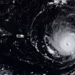
Second, there's health monitoring—both human and ecological. Microbiologists use GIS to map disease spread in plants and animals, predict epidemic potential in human populations, and understand how environmental conditions encourage or suppress pathogen growth. As climate change alters temperature and rainfall patterns, GIS helps predict how microbial threats might shift geographically.
You'll find GIS particularly valuable if you're interested in understanding historical ecology. By mapping fossilized pollen, ancient bacteria, and other microscopic evidence, researchers reconstruct past environments and predict future changes. These microbes are extremely sensitive to climate fluctuations, making them valuable indicators for understanding both past conditions and future scenarios.
Tracking Disease Spread with GIS
One of the most practical applications of GIS in environmental microbiology is tracking disease-causing bacteria and planning public health responses. The Campylobacter studies in the UK provide an excellent example of how this works in practice.
The Campylobacter Challenge
Campylobacter is the leading bacterial cause of foodborne illness in the UK and remains widespread in the United States. These bacteria don't survive well in the environment and can't spread directly between animals and people, which made identifying transmission routes particularly challenging. Health officials suspected standing water might be involved, but needed spatial data to confirm the hypothesis.
In a major study in northern England, researchers used GIS to map outbreak locations and plan strategic water sampling. They analyzed where cases clustered most heavily, then sampled standing water in those specific areas. The results were striking: approximately 40% of water samples contained Campylobacter bacteria. By mapping this data, researchers demonstrated that the bacteria spread through animal waste, contaminating water sources, which then entered the human food chain.
A parallel study in Sweden used similar GIS methods to identify risk factors and potential sources. While many questions about Campylobacter transmission remain, these spatial analyses gave health planners crucial information about how the bacteria spread and where to focus prevention efforts.
Career Applications
If you're interested in public health careers, this type of work exemplifies what epidemiologists and environmental health specialists do daily. You'd combine laboratory microbiology skills with spatial analysis to protect community health. Government agencies, health departments, and environmental consulting firms actively seek microbiologists with GIS experience for exactly this kind of disease surveillance work.
Mapping Agricultural Pathogens and Climate Change
Food security represents one of the 21st century's major challenges, and pathogenic fungi pose serious threats to crop production worldwide. Environmental microbiologists use GIS to track plant diseases and predict how climate change might alter their distribution.
Understanding Fungal Threats
Pathogenic fungi affect agriculture in two critical ways. First, widespread disease can restrict crop supply and drive up prices—primarily an economic issue unless it leads to famine. We depend heavily on staple crops like wheat and potatoes, and when disease affects these core crops, the impacts can be devastating. Research shows that crop diversity significantly affects how pathogens spread across farming regions.
Second, some biological diseases directly harm human health. Ergot fungi, for example, can cause illness and hallucinations in people who consume contaminated grain, potentially leading to long-term health problems for individuals or populations.
Climate Change and Disease Prediction
Climate change presents entirely new challenges for crop disease management. Some regions already experience regular drought, while others face increasing flooding—both conditions affect disease virulence. GIS has become essential for mapping current bacteria and virus distributions and predicting future spread patterns.
One of agriculture's biggest challenges is protecting potato crops from late blight (Phytophthora infestans), the same type of pathogen that caused the Irish Potato Famine. This disease has the potential to cause famine in developing nations where potatoes are a staple crop. Researchers use GIS extensively to plot problem areas and develop strategies to limit disease spread. By integrating climate data with known pathogen distribution patterns, scientists can predict potential spread based on climate variations and instability.
Why This Matters for Your Career
Agricultural microbiology offers diverse career paths combining laboratory work with field research. Environmental consulting firms, agricultural companies, and government agencies need specialists who can both identify pathogens in the lab and map their distribution across landscapes. If you're interested in conservation and food security, this specialization provides meaningful work with global impact.
GIS in Paleoenvironmental Research
Environmental microbiology isn't just about understanding today's ecosystems—it also helps us reconstruct ancient environments and predict future changes. This field is called paleoenvironmental research, and microbiologists play a crucial role.
Reconstructing Ancient Climates
The famous Greenland Ice Sheet data sets allowed researchers to reconstruct temperature records spanning about 800,000 years, based on carbon levels and atmospheric composition preserved in ice cores. But temperature is just one piece of the puzzle. Researchers also collect extensive microbiological data from the past—primarily fossilized pollen, bacteria, and fungal spores.
GIS helps researchers select optimal sampling sites. When studying broad environmental patterns, you need samples from diverse environments. When investigating specific questions, you need concentrated sampling in targeted locations. GIS mapping ensures efficient, strategic sample collection.
Case Study: Vegetation Mapping in Turkey
A comprehensive study used GIS to map paleovegetation patterns in southwestern Turkey, examining pollen evidence—one of the most ubiquitous and well-preserved ecological records. The research addressed three key questions: whether climate change could account for evidence of ancient lakes and vegetation patterns, how to explain the lack of tree expansion during the Holocene period, and how to map human occupation impacts on the ecology.
The results proved valuable not just for paleoecology, but also for archaeology and modern historical research. This exemplifies how environmental microbiology with GIS skills serves multiple scientific disciplines.
Career Opportunities in Research
Paleoenvironmental research typically requires graduate-level training, but it offers opportunities to contribute to climate science, evolutionary biology, and archaeology. Universities, museums, and research institutions employ specialists who can combine microbiological analysis with spatial data interpretation. If you're drawn to research careers, this specialization provides intellectually stimulating work at the intersection of multiple scientific fields.
Adding GIS Skills to Your Microbiology Degree
Here's the challenge: Environmental microbiology is a niche field, which means you won't find many undergraduate programs specifically combining microbiology with GIS. However, you can absolutely build this skill combination through strategic course selection.
Undergraduate Strategy
If you're pursuing a bachelor's degree in environmental microbiology or environmental biology, look for programs that offer GIS as an elective or minor. Not all schools provide this option, so it's worth asking admissions offices specifically about GIS availability when comparing programs. If GIS courses are offered, take them—even if they're not required for your major. The investment will pay off significantly in your career prospects.
Some students prefer to major in environmental science with a microbiology concentration, then take GIS courses as electives. Others major in microbiology and add a GIS minor if their university offers one. Both approaches work well.
Graduate Specialization
Your best opportunities to deeply integrate GIS with microbiology come at the master's and doctoral levels. Graduate programs increasingly recognize the value of spatial analysis tools and may offer GIS courses specifically designed for environmental science students. When researching graduate programs, ask about:
- GIS courses available to environmental microbiology students
- Faculty research involving spatial analysis
- Access to GIS laboratories and software
- Opportunities to use GIS in thesis or dissertation research
The preferred approach for graduate programs is to complete an undergraduate degree in environmental microbiology or a related field, then pursue a master's or PhD, where you can specialize in GIS applications. This path gives you solid microbiological foundations before adding advanced spatial analysis skills.
Certificate and Continuing Education
If you've already completed a microbiology degree without GIS training, don't worry. Many universities offer GIS certificate programs designed for working professionals. These typically run 12-18 months and provide comprehensive GIS training without requiring a full degree program. Online options make it possible to add these skills while working.
Some professional organizations also offer GIS workshops and short courses specifically for environmental professionals. While these won't replace formal education, they can help you determine if GIS specialization interests you before committing to a certificate or degree program.
Career Paths: Environmental Microbiology + GIS
The combination of environmental microbiology and GIS expertise opens doors across multiple sectors. Here's what you should know about career opportunities in this specialized field.
Public Health and Epidemiology
Government health departments at local, state, and federal levels need environmental microbiologists who can track disease patterns spatially. You might work for the Centers for Disease Control and Prevention (CDC), state health departments, or county public health agencies. Epidemiologists with microbiological training and GIS skills are particularly valuable for investigating foodborne illness outbreaks, waterborne disease transmission, and vector-borne disease spread.
These positions typically require a master's degree in microbiology, environmental health, or public health, along with demonstrated GIS competency. Starting salaries for entry-level positions range from $55,000 to $70,000 annually, with experienced epidemiologists earning $80,000 to $110,000.
Environmental Consulting
Private consulting firms hire environmental microbiologists to assess contamination sites, evaluate water quality, and investigate environmental health concerns. When you add GIS skills, you become more valuable because you can map contamination extent, predict pollutant movement, and present findings visually to clients and regulatory agencies.
Consultants typically work on diverse projects—one month investigating industrial site contamination, the next assessing agricultural runoff impacts. If you enjoy variety and client interaction, consulting offers excellent opportunities. Mid-level environmental consultants with microbiology and GIS expertise earn $65,000 to $90,000 annually.
Research Positions
Universities, research institutions, and government research agencies employ microbiologists who can integrate spatial analysis into their work. You might study climate change impacts on microbial communities, investigate emerging pathogens, or conduct basic research on microbial ecology. These positions almost always require a PhD, though some research assistant roles are available with a master's degree.
Academic research positions offer intellectual freedom and the opportunity to contribute new knowledge to the field. Postdoctoral researchers typically earn $50,000 to $65,000, while tenure-track faculty positions start around $70,000 to $90,000, depending on institution and geographic location.
Government Agencies
Federal agencies including the Environmental Protection Agency (EPA), U.S. Geological Survey (USGS), and National Oceanic and Atmospheric Administration (NOAA) hire environmental microbiologists with GIS skills. You might monitor water quality across regions, track harmful algal blooms, assess the impacts of environmental policies, or contribute to conservation planning.
Government positions offer job security, excellent benefits, and meaningful work contributing to environmental protection. GIS technicians and specialists in environmental agencies earn $55,000 to $85,000 annually, with senior scientists earning $90,000 to $120,000.
Required vs. Preferred Qualifications
Most positions require at a minimum a bachelor's degree in environmental microbiology, microbiology, environmental science, or a related field. GIS skills are often listed as "preferred" rather than "required," but in competitive job markets, preferred qualifications often determine who gets hired. You don't need to be a GIS expert—demonstrating coursework and basic competency is usually sufficient for entry-level positions. Advanced positions may require more extensive GIS experience or specific software expertise.
Salary and Job Outlook
Understanding salary expectations helps you make informed decisions about educational investments. Environmental scientists and specialists—including those with microbiology and GIS expertise—earn a median annual salary of $77,980 according to 2024 Bureau of Labor Statistics data. However, specialization and sector significantly affect compensation.
Salary by Sector
Your employer type influences earning potential:
- Federal government: Median salary of $109,990 annually, with environmental scientists in specialized roles earning the highest wages
- Management, scientific, and technical consulting: Median salary of $77,460 annually, with senior consultants earning significantly more
- State government: Median salary of $66,830 annually, though this varies considerably by state
- Local government: Median salary of $65,080 annually, with metropolitan areas typically offering higher compensation
- Research and development: Median salary of $95,540 annually, particularly for those with advanced degrees
The GIS Premium
While BLS doesn't track GIS skills separately, industry estimates suggest environmental scientists with GIS expertise earn 10-15% more than peers without spatial analysis skills. The combination of laboratory microbiology knowledge with spatial analysis capabilities makes you more versatile and valuable to employers.
Job Growth Projections
Employment for environmental scientists and specialists is projected to grow 6% from 2023 to 2033, about as fast as the average for all occupations. This translates to approximately 6,900 job openings annually nationwide. Growth drivers include increasing focus on environmental health, climate change impacts, and water quality management—all areas where microbiologists with GIS skills are particularly valuable.
Geographic Variations
Location significantly affects salary expectations. Environmental scientists in California earn median salaries around $95,000 annually, while those in Massachusetts average $90,000. States with lower costs of living typically offer proportionally lower salaries, though quality of life factors may balance the difference.
Metropolitan areas with strong environmental consulting markets or major research institutions typically offer the highest salaries. Consider both salary and cost of living when evaluating job opportunities.
Frequently Asked Questions
Do I need to major in GIS to use it in environmental microbiology?
No, you don't need a GIS major. Most environmental microbiologists develop GIS skills through elective courses, minors, or graduate training. A strong foundation in microbiology should be your priority, then add GIS competency through targeted coursework. Many successful professionals have learned GIS through certificate programs or on-the-job training after completing microbiology degrees.
Can I learn GIS during a graduate program in microbiology?
Yes, and graduate school actually offers excellent opportunities to integrate GIS into your specialization. Many master's and PhD programs in environmental microbiology offer GIS courses or allow you to take courses from geography or environmental science departments. You can also incorporate GIS into your thesis or dissertation research, gaining practical experience while completing your degree. When choosing graduate programs, ask specifically about GIS course availability and faculty research involving spatial analysis.
What GIS software do environmental microbiologists typically use?
ArcGIS from Esri is the industry standard, particularly in government agencies and consulting firms. However, QGIS—a free, open-source alternative—is increasingly popular in research settings and offers powerful capabilities without licensing costs. Most employers expect familiarity with at least one major GIS platform. Many universities teach both, giving you flexibility. Start with whichever your educational program offers, then expand your software knowledge based on career goals.
Is a GIS certification necessary for environmental microbiology jobs?
GIS certification isn't typically required, though it can strengthen your resume. The GIS Certification Institute offers the GISP (GIS Professional) credential, which demonstrates advanced competency. However, most employers prioritize demonstrable skills over formal certification. Completing GIS coursework, using GIS in research projects, or contributing to spatial analysis work during internships proves competency effectively. Consider certification if you're competing for positions where GIS is a primary job function.
What's the job market like for environmental microbiologists with GIS skills?
The job market is competitive but favorable for specialists with both skill sets. Environmental microbiology alone is somewhat niche, and adding GIS expertise makes you stand out significantly. Government agencies particularly value this combination for disease surveillance and environmental monitoring work. Start building your network early through internships, professional organization memberships, and graduate research connections. Many positions aren't publicly advertised but filled through professional networks.
Key Takeaways
- Essential Career Tool: GIS transforms environmental microbiology from purely laboratory work into spatially-informed environmental problem-solving, significantly expanding career opportunities in public health, conservation, and research.
- Strategic Education Path: Few undergraduate programs integrate microbiology with GIS, so take GIS as an elective if available. Graduate programs offer the best opportunities for deep specialization, combining both skill sets.
- Diverse Applications: Environmental microbiologists use GIS to track disease outbreaks, map pathogen distribution, predict climate change impacts on microbial communities, and reconstruct ancient ecosystems from microscopic evidence.
- Strong Salary Potential: Environmental scientists with specialized skills like microbiology plus GIS earn median salaries of $77,980 annually, with federal government positions averaging $109,990 and consulting roles offering $65,000-$90,000 for mid-level professionals.
- Growing Demand: The field projects 6% job growth through 2033, driven by increasing focus on environmental health, climate change monitoring, and water quality management—all areas where spatial microbiology expertise is increasingly valuable.
Ready to combine your passion for microbiology with cutting-edge spatial technology? Explore environmental microbiology programs that prepare you for careers at the intersection of laboratory science and geospatial analysis.
Related Degrees
2024 US Bureau of Labor Statistics salary and job growth figures for Environmental Scientists and Specialists reflect state and national data, not school-specific information. Conditions in your area may vary. Data accessed January 2026.
- What Is Parasitology? The Science of Parasites Explained - November 19, 2018
- Desert Ecosystems: Types, Ecology, and Global Importance - November 19, 2018
- Conservation: History and Future - September 14, 2018
Related Articles


Featured Article
Geospatial Technology: An Introduction and Overview